You are here: Home > Network List > US - United States National Seismic Network Stations List
> Station EGMT Eagleton, Montana, USA > Earthquake Result Viewer
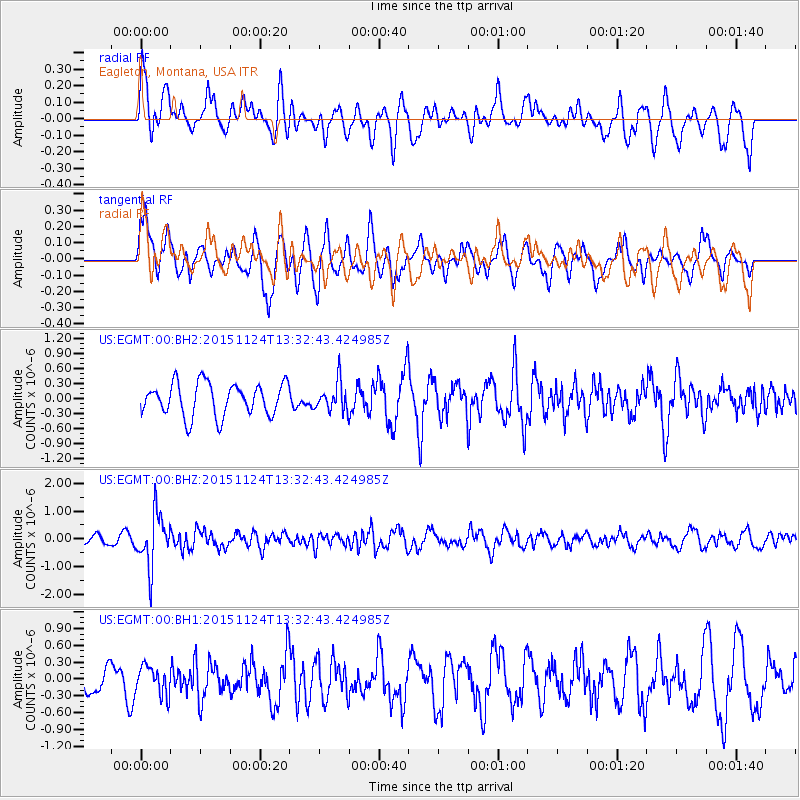
EGMT Eagleton, Montana, USA - Earthquake Result Viewer
*The percent match for this event was below the threshold and hence no stack was calculated.
| Earthquake location: |
Mariana Islands |
| Earthquake latitude/longitude: |
18.8/145.3 |
| Earthquake time(UTC): |
2015/11/24 (328) 13:21:36 GMT |
| Earthquake Depth: |
586 km |
| Earthquake Magnitude: |
5.9 MWB |
| Earthquake Catalog/Contributor: |
NEIC PDE/NEIC COMCAT |
|
| Network: |
US United States National Seismic Network |
| Station: |
EGMT Eagleton, Montana, USA |
| Lat/Lon: |
48.02 N/109.75 W |
| Elevation: |
1055 m |
|
| Distance: |
85.8 deg |
| Az: |
40.567 deg |
| Baz: |
293.386 deg |
| Ray Param: |
$rayparam |
*The percent match for this event was below the threshold and hence was not used in the summary stack. |
|
| Radial Match: |
49.92954 % |
| Radial Bump: |
400 |
| Transverse Match: |
67.89704 % |
| Transverse Bump: |
400 |
| SOD ConfigId: |
1259291 |
| Insert Time: |
2015-12-08 13:45:27.641 +0000 |
| GWidth: |
2.5 |
| Max Bumps: |
400 |
| Tol: |
0.001 |
|
Signal To Noise
| Channel | StoN | STA | LTA |
| US:EGMT:00:BHZ:20151124T13:32:43.424985Z | 8.446878 | 9.4244507E-7 | 1.1157318E-7 |
| US:EGMT:00:BH1:20151124T13:32:43.424985Z | 1.1285818 | 2.5659003E-7 | 2.2735618E-7 |
| US:EGMT:00:BH2:20151124T13:32:43.424985Z | 0.88085914 | 2.8527433E-7 | 3.2385918E-7 |
| Arrivals |
| Ps | |
| PpPs | |
| PsPs/PpSs | |


