You are here: Home > Network List > CI - Caltech Regional Seismic Network Stations List
> Station DAN Danby, California, USA > Earthquake Result Viewer
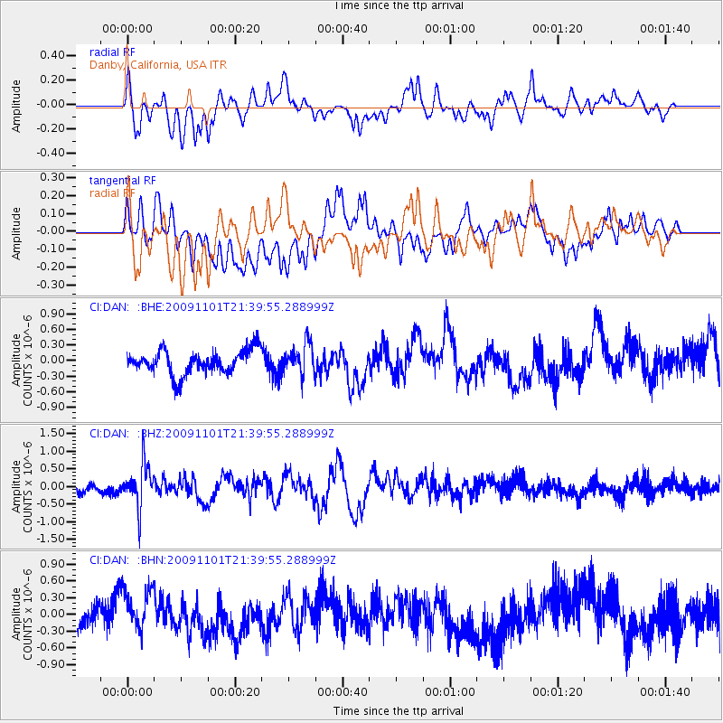
DAN Danby, California, USA - Earthquake Result Viewer
*The percent match for this event was below the threshold and hence no stack was calculated.
| Earthquake location: |
Tonga Islands |
| Earthquake latitude/longitude: |
-15.5/-173.8 |
| Earthquake time(UTC): |
2009/11/01 (305) 21:28:58 GMT |
| Earthquake Depth: |
105 km |
| Earthquake Magnitude: |
5.8 MW, 5.4 MB, 5.8 MW |
| Earthquake Catalog/Contributor: |
WHDF/NEIC |
|
| Network: |
CI Caltech Regional Seismic Network |
| Station: |
DAN Danby, California, USA |
| Lat/Lon: |
34.64 N/115.38 W |
| Elevation: |
398 m |
|
| Distance: |
74.5 deg |
| Az: |
46.755 deg |
| Baz: |
238.396 deg |
| Ray Param: |
$rayparam |
*The percent match for this event was below the threshold and hence was not used in the summary stack. |
|
| Radial Match: |
65.67526 % |
| Radial Bump: |
400 |
| Transverse Match: |
45.404625 % |
| Transverse Bump: |
400 |
| SOD ConfigId: |
2622 |
| Insert Time: |
2010-02-26 01:06:27.702 +0000 |
| GWidth: |
2.5 |
| Max Bumps: |
400 |
| Tol: |
0.001 |
|
Signal To Noise
| Channel | StoN | STA | LTA |
| CI:DAN: :BHZ:20091101T21:39:55.288999Z | 3.7450109 | 6.024588E-7 | 1.608697E-7 |
| CI:DAN: :BHN:20091101T21:39:55.288999Z | 2.4707613 | 3.8396027E-7 | 1.554016E-7 |
| CI:DAN: :BHE:20091101T21:39:55.288999Z | 1.2736709 | 2.9318875E-7 | 2.3019192E-7 |
| Arrivals |
| Ps | |
| PpPs | |
| PsPs/PpSs | |


