You are here: Home > Network List > CI - Caltech Regional Seismic Network Stations List
> Station DAN Danby, California, USA > Earthquake Result Viewer
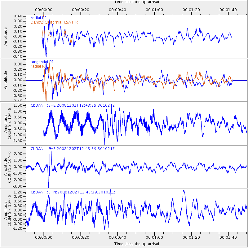
DAN Danby, California, USA - Earthquake Result Viewer
*The percent match for this event was below the threshold and hence no stack was calculated.
| Earthquake location: |
Mariana Islands |
| Earthquake latitude/longitude: |
19.1/145.8 |
| Earthquake time(UTC): |
2008/12/02 (337) 12:31:43 GMT |
| Earthquake Depth: |
137 km |
| Earthquake Magnitude: |
5.9 MB, 5.9 MW, 5.9 MW |
| Earthquake Catalog/Contributor: |
WHDF/NEIC |
|
| Network: |
CI Caltech Regional Seismic Network |
| Station: |
DAN Danby, California, USA |
| Lat/Lon: |
34.64 N/115.38 W |
| Elevation: |
398 m |
|
| Distance: |
86.3 deg |
| Az: |
54.722 deg |
| Baz: |
290.58 deg |
| Ray Param: |
$rayparam |
*The percent match for this event was below the threshold and hence was not used in the summary stack. |
|
| Radial Match: |
55.52516 % |
| Radial Bump: |
400 |
| Transverse Match: |
49.28332 % |
| Transverse Bump: |
341 |
| SOD ConfigId: |
2658 |
| Insert Time: |
2010-02-26 01:06:34.114 +0000 |
| GWidth: |
2.5 |
| Max Bumps: |
400 |
| Tol: |
0.001 |
|
Signal To Noise
| Channel | StoN | STA | LTA |
| CI:DAN: :BHZ:20081202T12:43:39.301021Z | 4.692072 | 1.3730702E-6 | 2.9263623E-7 |
| CI:DAN: :BHN:20081202T12:43:39.301021Z | 0.71415377 | 4.921833E-7 | 6.891839E-7 |
| CI:DAN: :BHE:20081202T12:43:39.301021Z | 1.1252531 | 6.824116E-7 | 6.064517E-7 |
| Arrivals |
| Ps | |
| PpPs | |
| PsPs/PpSs | |


