V28A Channing, TX, USA - Earthquake Result Viewer
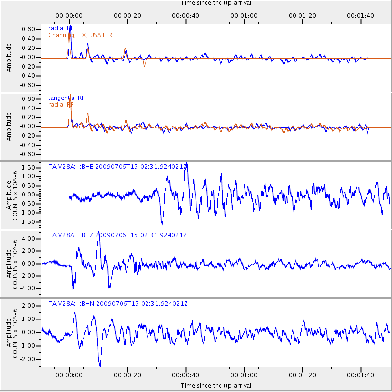
Earthquake location: Rat Islands, Aleutian Islands
Earthquake latitude/longitude: 50.4/177.0
Earthquake time(UTC): 2009/07/06 (187) 14:53:12 GMT
Earthquake Depth: 22 km
Earthquake Magnitude: 6.0 MB, 5.8 MS, 6.1 MW, 6.0 MW
Earthquake Catalog/Contributor: WHDF/NEIC
Network: TA USArray Transportable Network (new EarthScope stations)
Station: V28A Channing, TX, USA
Lat/Lon: 35.75 N/102.22 W
Elevation: 1163 m
Distance: 58.0 deg
Az: 71.297 deg
Baz: 311.87 deg
Ray Param: 0.06312707
Estimated Moho Depth: 45.0 km
Estimated Crust Vp/Vs: 1.84
Assumed Crust Vp: 6.242 km/s
Estimated Crust Vs: 3.388 km/s
Estimated Crust Poisson's Ratio: 0.29
Radial Match: 91.334564 %
Radial Bump: 336
Transverse Match: 75.797646 %
Transverse Bump: 400
SOD ConfigId: 2648
Insert Time: 2010-03-05 23:00:28.630 +0000
GWidth: 2.5
Max Bumps: 400
Tol: 0.001

Signal To Noise

ChannelStoNSTALTA
TA:V28A: :BHZ:20090706T15:02:31.924021Z5.8782111.8587666E-63.1621298E-7
TA:V28A: :BHN:20090706T15:02:31.924021Z2.42081387.281288E-73.007785E-7
TA:V28A: :BHE:20090706T15:02:31.924021Z5.38463167.4370325E-71.381159E-7
Arrivals
Ps6.3 SECOND
PpPs20 SECOND
PsPs/PpSs26 SECOND