
V28A Channing, TX, USA - Earthquake Result Viewer
| ||||||||||||||||||
| ||||||||||||||||||
| ||||||||||||||||||
|
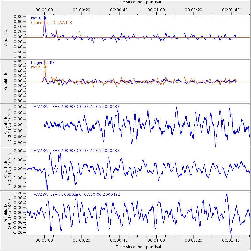
Signal To Noise
| Channel | StoN | STA | LTA |
| TA:V28A: :BHZ:20090330T07:20:06.200013Z | 5.2778034 | 1.0793003E-6 | 2.04498E-7 |
| TA:V28A: :BHN:20090330T07:20:06.200013Z | 3.1742935 | 5.5692936E-7 | 1.7544987E-7 |
| TA:V28A: :BHE:20090330T07:20:06.200013Z | 2.5457542 | 3.9700316E-7 | 1.5594716E-7 |
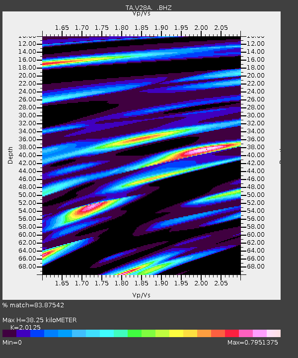
| Arrivals | |
| Ps | 6.6 SECOND |
| PpPs | 17 SECOND |
| PsPs/PpSs | 24 SECOND |

