You are here: Home > Network List > WY - Yellowstone Wyoming Seismic Network Stations List
> Station YHH Holmes Hill, YNP, WY, USA > Earthquake Result Viewer
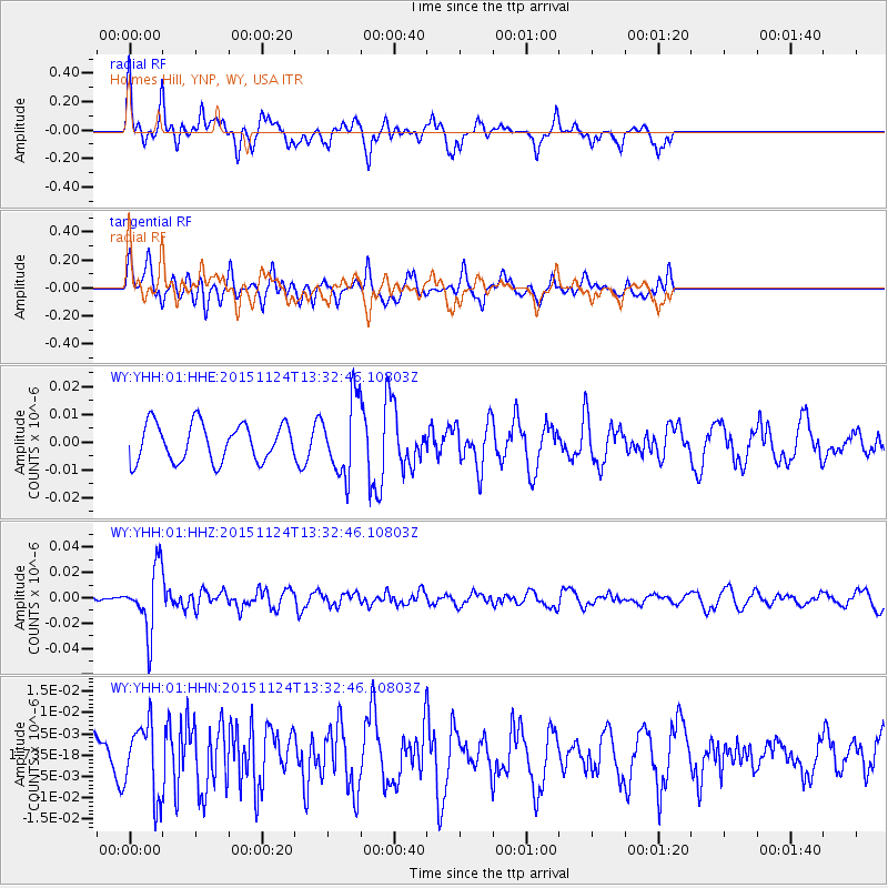
YHH Holmes Hill, YNP, WY, USA - Earthquake Result Viewer
*The percent match for this event was below the threshold and hence no stack was calculated.
| Earthquake location: |
Mariana Islands |
| Earthquake latitude/longitude: |
18.8/145.3 |
| Earthquake time(UTC): |
2015/11/24 (328) 13:21:36 GMT |
| Earthquake Depth: |
586 km |
| Earthquake Magnitude: |
5.9 MWB |
| Earthquake Catalog/Contributor: |
NEIC PDE/NEIC COMCAT |
|
| Network: |
WY Yellowstone Wyoming Seismic Network |
| Station: |
YHH Holmes Hill, YNP, WY, USA |
| Lat/Lon: |
44.79 N/110.85 W |
| Elevation: |
2717 m |
|
| Distance: |
86.4 deg |
| Az: |
43.85 deg |
| Baz: |
292.818 deg |
| Ray Param: |
$rayparam |
*The percent match for this event was below the threshold and hence was not used in the summary stack. |
|
| Radial Match: |
76.84772 % |
| Radial Bump: |
393 |
| Transverse Match: |
62.70933 % |
| Transverse Bump: |
400 |
| SOD ConfigId: |
1259291 |
| Insert Time: |
2015-12-08 13:48:47.395 +0000 |
| GWidth: |
2.5 |
| Max Bumps: |
400 |
| Tol: |
0.001 |
|
Signal To Noise
| Channel | StoN | STA | LTA |
| WY:YHH:01:HHZ:20151124T13:32:46.10803Z | 3.9181004 | 2.4723573E-8 | 6.3100916E-9 |
| WY:YHH:01:HHN:20151124T13:32:46.10803Z | 1.660729 | 8.434826E-9 | 5.07899E-9 |
| WY:YHH:01:HHE:20151124T13:32:46.10803Z | 1.9858241 | 1.3443994E-8 | 6.7699824E-9 |
| Arrivals |
| Ps | |
| PpPs | |
| PsPs/PpSs | |


