You are here: Home > Network List > TA - USArray Transportable Network (new EarthScope stations) Stations List
> Station V28A Channing, TX, USA > Earthquake Result Viewer
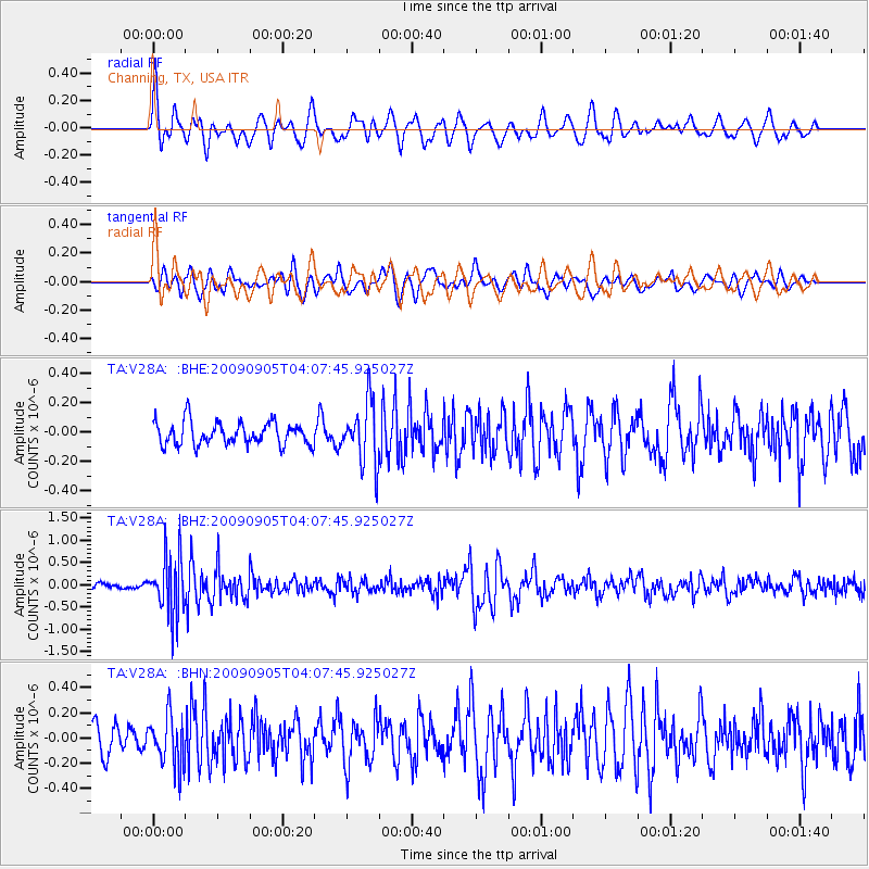
V28A Channing, TX, USA - Earthquake Result Viewer
*The percent match for this event was below the threshold and hence no stack was calculated.
| Earthquake location: |
Southern Peru |
| Earthquake latitude/longitude: |
-15.1/-70.2 |
| Earthquake time(UTC): |
2009/09/05 (248) 03:58:39 GMT |
| Earthquake Depth: |
210 km |
| Earthquake Magnitude: |
5.8 MW, 5.2 MB, 5.8 MW |
| Earthquake Catalog/Contributor: |
WHDF/NEIC |
|
| Network: |
TA USArray Transportable Network (new EarthScope stations) |
| Station: |
V28A Channing, TX, USA |
| Lat/Lon: |
35.75 N/102.22 W |
| Elevation: |
1163 m |
|
| Distance: |
59.0 deg |
| Az: |
329.818 deg |
| Baz: |
143.349 deg |
| Ray Param: |
$rayparam |
*The percent match for this event was below the threshold and hence was not used in the summary stack. |
|
| Radial Match: |
66.12275 % |
| Radial Bump: |
400 |
| Transverse Match: |
57.20459 % |
| Transverse Bump: |
400 |
| SOD ConfigId: |
2622 |
| Insert Time: |
2010-03-05 23:00:52.143 +0000 |
| GWidth: |
2.5 |
| Max Bumps: |
400 |
| Tol: |
0.001 |
|
Signal To Noise
| Channel | StoN | STA | LTA |
| TA:V28A: :BHZ:20090905T04:07:45.925027Z | 7.31749 | 6.528164E-7 | 8.921315E-8 |
| TA:V28A: :BHN:20090905T04:07:45.925027Z | 1.9284686 | 1.984936E-7 | 1.0292809E-7 |
| TA:V28A: :BHE:20090905T04:07:45.925027Z | 2.7276783 | 2.0996212E-7 | 7.6974665E-8 |
| Arrivals |
| Ps | |
| PpPs | |
| PsPs/PpSs | |


