You are here: Home > Network List > TA - USArray Transportable Network (new EarthScope stations) Stations List
> Station V28A Channing, TX, USA > Earthquake Result Viewer
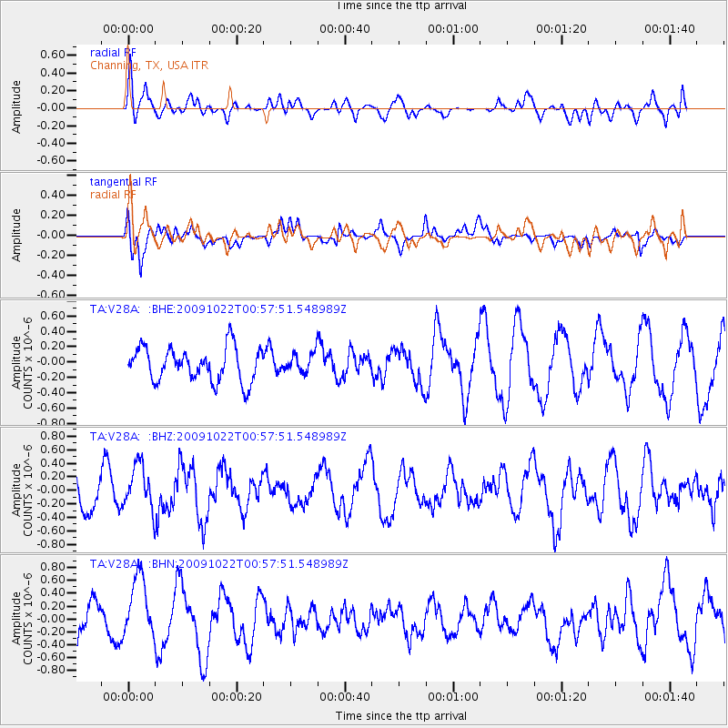
V28A Channing, TX, USA - Earthquake Result Viewer
*The percent match for this event was below the threshold and hence no stack was calculated.
| Earthquake location: |
South Of Panama |
| Earthquake latitude/longitude: |
6.7/-82.6 |
| Earthquake time(UTC): |
2009/10/22 (295) 00:51:39 GMT |
| Earthquake Depth: |
18 km |
| Earthquake Magnitude: |
5.5 MB, 5.4 MS, 5.9 MW, 5.9 MW |
| Earthquake Catalog/Contributor: |
WHDF/NEIC |
|
| Network: |
TA USArray Transportable Network (new EarthScope stations) |
| Station: |
V28A Channing, TX, USA |
| Lat/Lon: |
35.75 N/102.22 W |
| Elevation: |
1163 m |
|
| Distance: |
34.0 deg |
| Az: |
330.762 deg |
| Baz: |
143.388 deg |
| Ray Param: |
$rayparam |
*The percent match for this event was below the threshold and hence was not used in the summary stack. |
|
| Radial Match: |
30.359106 % |
| Radial Bump: |
392 |
| Transverse Match: |
61.450478 % |
| Transverse Bump: |
400 |
| SOD ConfigId: |
2622 |
| Insert Time: |
2010-03-05 23:01:01.237 +0000 |
| GWidth: |
2.5 |
| Max Bumps: |
400 |
| Tol: |
0.001 |
|
Signal To Noise
| Channel | StoN | STA | LTA |
| TA:V28A: :BHZ:20091022T00:57:51.548989Z | 1.2007129 | 3.2855493E-7 | 2.7363322E-7 |
| TA:V28A: :BHN:20091022T00:57:51.548989Z | 2.3038557 | 4.7358256E-7 | 2.0556087E-7 |
| TA:V28A: :BHE:20091022T00:57:51.548989Z | 0.5942723 | 1.2954509E-7 | 2.1798944E-7 |
| Arrivals |
| Ps | |
| PpPs | |
| PsPs/PpSs | |


