You are here: Home > Network List > TA - USArray Transportable Network (new EarthScope stations) Stations List
> Station R33M Jennings River, BC, CAN > Earthquake Result Viewer
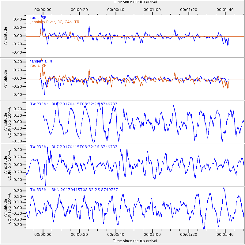
R33M Jennings River, BC, CAN - Earthquake Result Viewer
*The percent match for this event was below the threshold and hence no stack was calculated.
| Earthquake location: |
Chile-Argentina Border Region |
| Earthquake latitude/longitude: |
-23.2/-67.7 |
| Earthquake time(UTC): |
2017/04/15 (105) 08:19:41 GMT |
| Earthquake Depth: |
135 km |
| Earthquake Magnitude: |
6.2 Mww |
| Earthquake Catalog/Contributor: |
NEIC PDE/us |
|
| Network: |
TA USArray Transportable Network (new EarthScope stations) |
| Station: |
R33M Jennings River, BC, CAN |
| Lat/Lon: |
59.39 N/130.97 W |
| Elevation: |
1437 m |
|
| Distance: |
97.2 deg |
| Az: |
332.56 deg |
| Baz: |
124.062 deg |
| Ray Param: |
$rayparam |
*The percent match for this event was below the threshold and hence was not used in the summary stack. |
|
| Radial Match: |
76.01544 % |
| Radial Bump: |
400 |
| Transverse Match: |
75.48699 % |
| Transverse Bump: |
349 |
| SOD ConfigId: |
11737051 |
| Insert Time: |
2019-04-27 02:56:26.729 +0000 |
| GWidth: |
2.5 |
| Max Bumps: |
400 |
| Tol: |
0.001 |
|
Signal To Noise
| Channel | StoN | STA | LTA |
| TA:R33M: :BHZ:20170415T08:32:26.874973Z | 1.757869 | 2.9802555E-7 | 1.6953798E-7 |
| TA:R33M: :BHN:20170415T08:32:26.874973Z | 0.7532956 | 7.020961E-8 | 9.320326E-8 |
| TA:R33M: :BHE:20170415T08:32:26.874973Z | 1.4605507 | 2.21142E-7 | 1.5141002E-7 |
| Arrivals |
| Ps | |
| PpPs | |
| PsPs/PpSs | |


