
O12A Currie, NV, USA - Earthquake Result Viewer
| ||||||||||||||||||
| ||||||||||||||||||
| ||||||||||||||||||
|
Signal To Noise
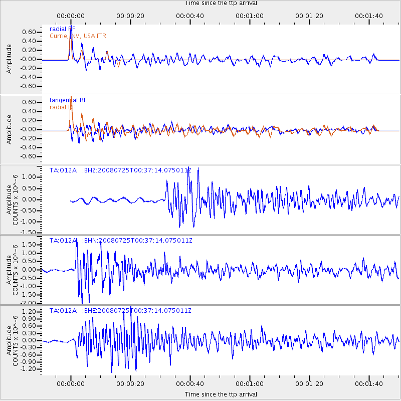
| Channel | StoN | STA | LTA |
| TA:O12A: :BHN:20080725T00:37:14.075011Z | 11.40625 | 8.58893E-7 | 7.530021E-8 |
| TA:O12A: :BHE:20080725T00:37:14.075011Z | 6.596947 | 2.857343E-7 | 4.331311E-8 |
| TA:O12A: :BHZ:20080725T00:37:14.075011Z | 4.8431005 | 3.7984796E-7 | 7.8430745E-8 |
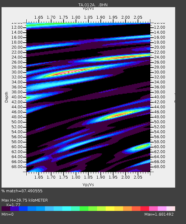
| Arrivals | |
| Ps | 3.9 SECOND |
| PpPs | 12 SECOND |
| PsPs/PpSs | 16 SECOND |

