O12A Currie, NV, USA - Earthquake Result Viewer
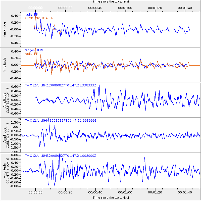
Earthquake location: Lake Baykal Region, Russia
Earthquake latitude/longitude: 51.6/104.2
Earthquake time(UTC): 2008/08/27 (240) 01:35:32 GMT
Earthquake Depth: 16 km
Earthquake Magnitude: 5.8 MB, 6.2 MS, 6.2 MW, 6.2 MW
Earthquake Catalog/Contributor: WHDF/NEIC
Network: TA USArray Transportable Network (new EarthScope stations)
Station: O12A Currie, NV, USA
Lat/Lon: 40.27 N/114.75 W
Elevation: 1743 m
Distance: 82.4 deg
Az: 28.998 deg
Baz: 336.728 deg
Ray Param: 0.04689153
Estimated Moho Depth: 32.0 km
Estimated Crust Vp/Vs: 1.71
Assumed Crust Vp: 6.276 km/s
Estimated Crust Vs: 3.665 km/s
Estimated Crust Poisson's Ratio: 0.24
Radial Match: 86.19257 %
Radial Bump: 400
Transverse Match: 85.06571 %
Transverse Bump: 400
SOD ConfigId: 2504
Insert Time: 2010-03-05 23:02:14.759 +0000
GWidth: 2.5
Max Bumps: 400
Tol: 0.001

Signal To Noise

ChannelStoNSTALTA
TA:O12A: :BHN:20080827T01:47:21.998999Z6.337495.293234E-78.352256E-8
TA:O12A: :BHE:20080827T01:47:21.998999Z2.82980591.6136133E-75.702205E-8
TA:O12A: :BHZ:20080827T01:47:21.998999Z0.8818657.388178E-88.377901E-8
Arrivals
Ps3.7 SECOND
PpPs13 SECOND
PsPs/PpSs17 SECOND