
O12A Currie, NV, USA - Earthquake Result Viewer
| ||||||||||||||||||
| ||||||||||||||||||
| ||||||||||||||||||
|
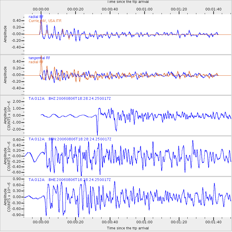
Signal To Noise
| Channel | StoN | STA | LTA |
| TA:O12A: :BHN:20060806T18:28:24.250017Z | 1.6833514 | 2.3199317E-7 | 1.3781624E-7 |
| TA:O12A: :BHE:20060806T18:28:24.250017Z | 5.795253 | 3.810493E-7 | 6.5751976E-8 |
| TA:O12A: :BHZ:20060806T18:28:24.250017Z | 6.567229 | 9.095706E-7 | 1.3850142E-7 |
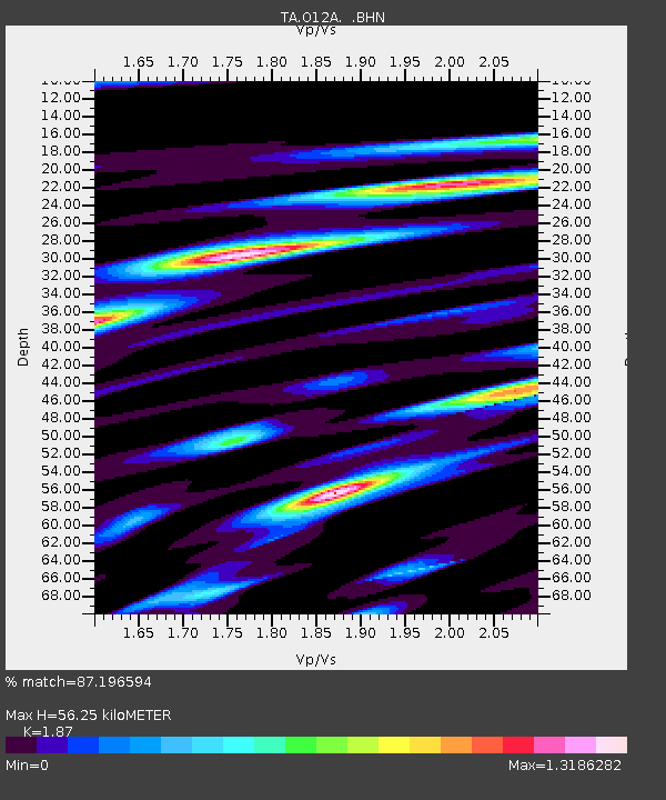
| Arrivals | |
| Ps | 8.0 SECOND |
| PpPs | 25 SECOND |
| PsPs/PpSs | 33 SECOND |

