
O12A Currie, NV, USA - Earthquake Result Viewer
| ||||||||||||||||||
| ||||||||||||||||||
| ||||||||||||||||||
|
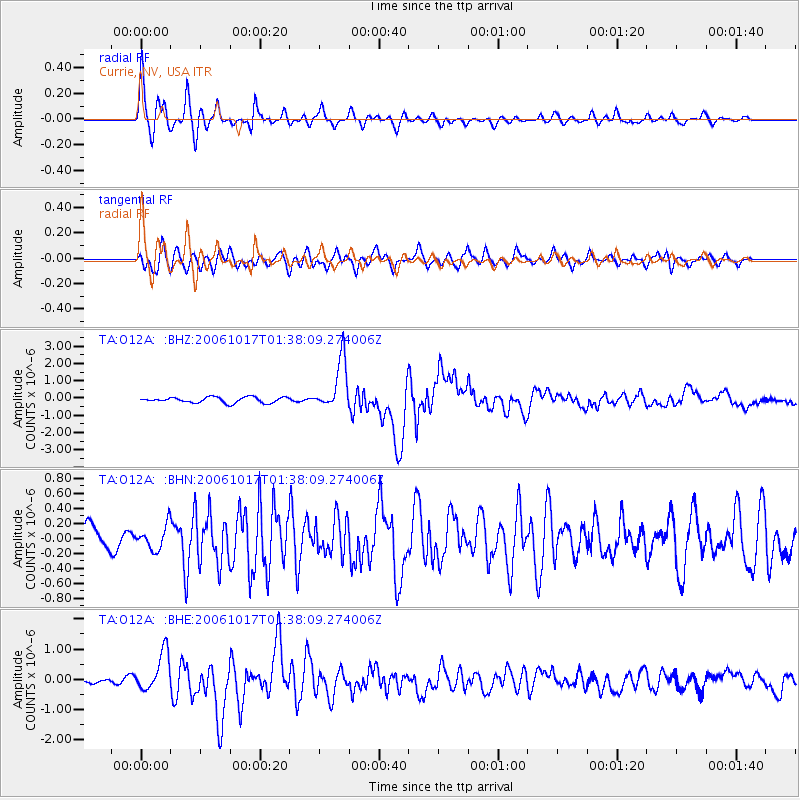
Signal To Noise
| Channel | StoN | STA | LTA |
| TA:O12A: :BHN:20061017T01:38:09.274006Z | 0.6537984 | 1.6040995E-7 | 2.453508E-7 |
| TA:O12A: :BHE:20061017T01:38:09.274006Z | 4.344101 | 6.408181E-7 | 1.4751454E-7 |
| TA:O12A: :BHZ:20061017T01:38:09.274006Z | 8.829488 | 1.445413E-6 | 1.6370292E-7 |
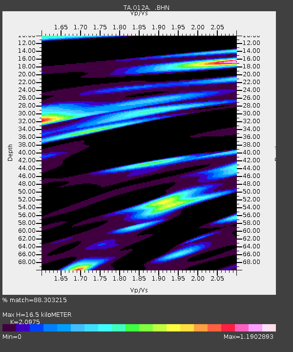
| Arrivals | |
| Ps | 2.9 SECOND |
| PpPs | 8.0 SECOND |
| PsPs/PpSs | 11 SECOND |

