You are here: Home > Network List > TA - USArray Transportable Network (new EarthScope stations) Stations List
> Station J26L Joseph Creek, AK, USA > Earthquake Result Viewer
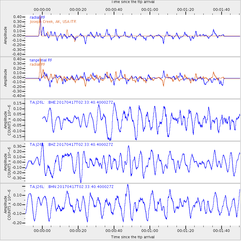
J26L Joseph Creek, AK, USA - Earthquake Result Viewer
*The percent match for this event was below the threshold and hence no stack was calculated.
| Earthquake location: |
Vanuatu Islands |
| Earthquake latitude/longitude: |
-13.4/166.5 |
| Earthquake time(UTC): |
2017/04/17 (107) 02:21:32 GMT |
| Earthquake Depth: |
20 km |
| Earthquake Magnitude: |
5.7 Mww |
| Earthquake Catalog/Contributor: |
NEIC PDE/us |
|
| Network: |
TA USArray Transportable Network (new EarthScope stations) |
| Station: |
J26L Joseph Creek, AK, USA |
| Lat/Lon: |
64.50 N/143.56 W |
| Elevation: |
1144 m |
|
| Distance: |
86.3 deg |
| Az: |
19.376 deg |
| Baz: |
228.238 deg |
| Ray Param: |
$rayparam |
*The percent match for this event was below the threshold and hence was not used in the summary stack. |
|
| Radial Match: |
58.702156 % |
| Radial Bump: |
332 |
| Transverse Match: |
49.287647 % |
| Transverse Bump: |
354 |
| SOD ConfigId: |
11737051 |
| Insert Time: |
2019-04-27 03:08:29.332 +0000 |
| GWidth: |
2.5 |
| Max Bumps: |
400 |
| Tol: |
0.001 |
|
Signal To Noise
| Channel | StoN | STA | LTA |
| TA:J26L: :BHZ:20170417T02:33:40.400027Z | 2.8172345 | 1.9952836E-7 | 7.082419E-8 |
| TA:J26L: :BHN:20170417T02:33:40.400027Z | 1.3617314 | 9.109478E-8 | 6.689629E-8 |
| TA:J26L: :BHE:20170417T02:33:40.400027Z | 1.5409254 | 6.791323E-8 | 4.4073015E-8 |
| Arrivals |
| Ps | |
| PpPs | |
| PsPs/PpSs | |


