You are here: Home > Network List > UW - Pacific Northwest Regional Seismic Network Stations List
> Station UMAT Pilot Rock, OR, USA > Earthquake Result Viewer
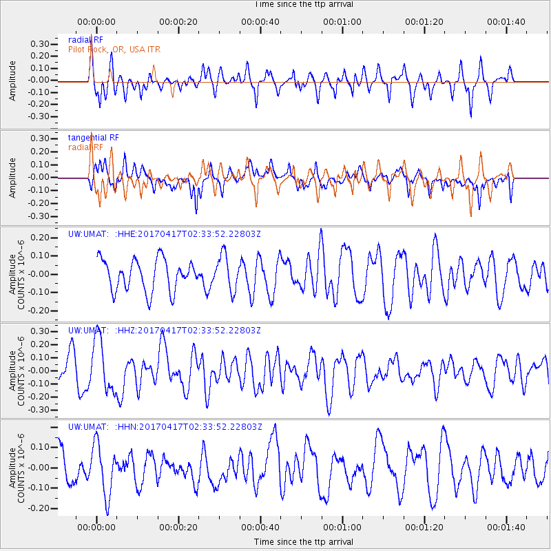
UMAT Pilot Rock, OR, USA - Earthquake Result Viewer
*The percent match for this event was below the threshold and hence no stack was calculated.
| Earthquake location: |
Vanuatu Islands |
| Earthquake latitude/longitude: |
-13.4/166.5 |
| Earthquake time(UTC): |
2017/04/17 (107) 02:21:32 GMT |
| Earthquake Depth: |
20 km |
| Earthquake Magnitude: |
5.7 Mww |
| Earthquake Catalog/Contributor: |
NEIC PDE/us |
|
| Network: |
UW Pacific Northwest Regional Seismic Network |
| Station: |
UMAT Pilot Rock, OR, USA |
| Lat/Lon: |
45.29 N/118.96 W |
| Elevation: |
1318 m |
|
| Distance: |
88.8 deg |
| Az: |
42.873 deg |
| Baz: |
249.718 deg |
| Ray Param: |
$rayparam |
*The percent match for this event was below the threshold and hence was not used in the summary stack. |
|
| Radial Match: |
63.911823 % |
| Radial Bump: |
400 |
| Transverse Match: |
66.00257 % |
| Transverse Bump: |
400 |
| SOD ConfigId: |
11737051 |
| Insert Time: |
2019-04-27 03:09:34.693 +0000 |
| GWidth: |
2.5 |
| Max Bumps: |
400 |
| Tol: |
0.001 |
|
Signal To Noise
| Channel | StoN | STA | LTA |
| UW:UMAT: :HHZ:20170417T02:33:52.22803Z | 1.9357954 | 2.1052324E-7 | 1.08752836E-7 |
| UW:UMAT: :HHN:20170417T02:33:52.22803Z | 1.3289229 | 1.3016312E-7 | 9.794633E-8 |
| UW:UMAT: :HHE:20170417T02:33:52.22803Z | 1.2805051 | 1.028535E-7 | 8.03226E-8 |
| Arrivals |
| Ps | |
| PpPs | |
| PsPs/PpSs | |


