You are here: Home > Network List > TA - USArray Transportable Network (new EarthScope stations) Stations List
> Station O12A Currie, NV, USA > Earthquake Result Viewer
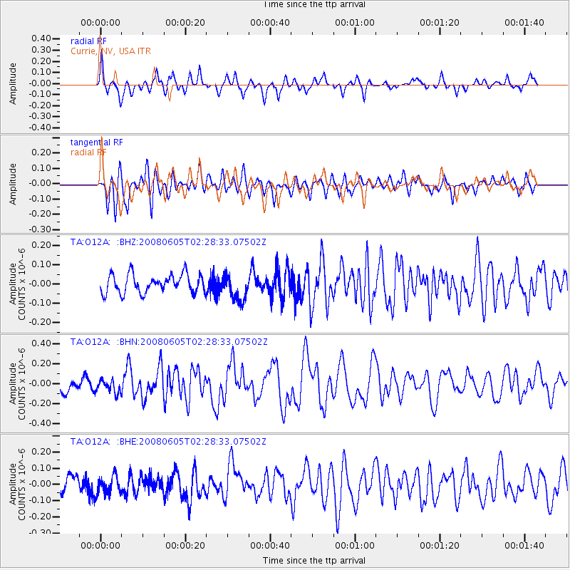
O12A Currie, NV, USA - Earthquake Result Viewer
*The percent match for this event was below the threshold and hence no stack was calculated.
| Earthquake location: |
West Chile Rise |
| Earthquake latitude/longitude: |
-38.8/-91.6 |
| Earthquake time(UTC): |
2008/06/05 (157) 02:16:46 GMT |
| Earthquake Depth: |
10 km |
| Earthquake Magnitude: |
5.6 MS, 5.4 MB, 6.0 MW, 6.0 MW |
| Earthquake Catalog/Contributor: |
WHDF/NEIC |
|
| Network: |
TA USArray Transportable Network (new EarthScope stations) |
| Station: |
O12A Currie, NV, USA |
| Lat/Lon: |
40.27 N/114.75 W |
| Elevation: |
1743 m |
|
| Distance: |
81.5 deg |
| Az: |
342.314 deg |
| Baz: |
161.938 deg |
| Ray Param: |
$rayparam |
*The percent match for this event was below the threshold and hence was not used in the summary stack. |
|
| Radial Match: |
68.29275 % |
| Radial Bump: |
400 |
| Transverse Match: |
56.457382 % |
| Transverse Bump: |
400 |
| SOD ConfigId: |
2504 |
| Insert Time: |
2010-03-05 23:04:25.872 +0000 |
| GWidth: |
2.5 |
| Max Bumps: |
400 |
| Tol: |
0.001 |
|
Signal To Noise
| Channel | StoN | STA | LTA |
| TA:O12A: :BHN:20080605T02:28:33.07502Z | 0.9497676 | 6.304791E-8 | 6.6382455E-8 |
| TA:O12A: :BHE:20080605T02:28:33.07502Z | 0.74171954 | 5.174061E-8 | 6.975765E-8 |
| TA:O12A: :BHZ:20080605T02:28:33.07502Z | 1.4407651 | 6.910907E-8 | 4.7966925E-8 |
| Arrivals |
| Ps | |
| PpPs | |
| PsPs/PpSs | |


