You are here: Home > Network List > TA - USArray Transportable Network (new EarthScope stations) Stations List
> Station O12A Currie, NV, USA > Earthquake Result Viewer
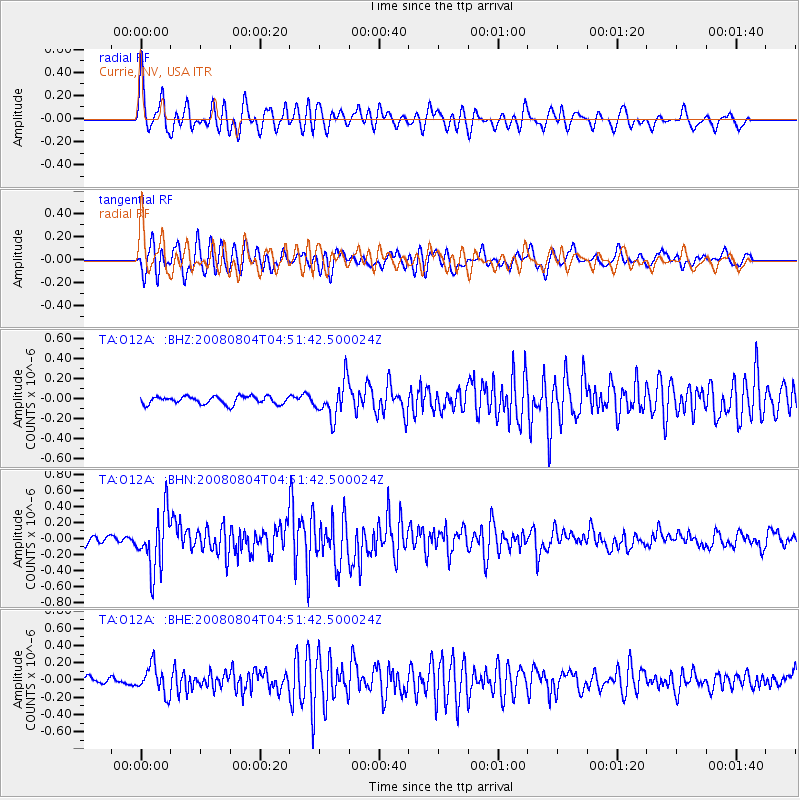
O12A Currie, NV, USA - Earthquake Result Viewer
*The percent match for this event was below the threshold and hence no stack was calculated.
| Earthquake location: |
Kuril Islands |
| Earthquake latitude/longitude: |
49.9/156.4 |
| Earthquake time(UTC): |
2008/08/04 (217) 04:42:14 GMT |
| Earthquake Depth: |
77 km |
| Earthquake Magnitude: |
5.6 MB, 5.8 MW, 5.7 MW |
| Earthquake Catalog/Contributor: |
WHDF/NEIC |
|
| Network: |
TA USArray Transportable Network (new EarthScope stations) |
| Station: |
O12A Currie, NV, USA |
| Lat/Lon: |
40.27 N/114.75 W |
| Elevation: |
1743 m |
|
| Distance: |
60.0 deg |
| Az: |
62.086 deg |
| Baz: |
311.623 deg |
| Ray Param: |
$rayparam |
*The percent match for this event was below the threshold and hence was not used in the summary stack. |
|
| Radial Match: |
77.244965 % |
| Radial Bump: |
400 |
| Transverse Match: |
81.84167 % |
| Transverse Bump: |
400 |
| SOD ConfigId: |
2504 |
| Insert Time: |
2010-03-05 23:04:29.869 +0000 |
| GWidth: |
2.5 |
| Max Bumps: |
400 |
| Tol: |
0.001 |
|
Signal To Noise
| Channel | StoN | STA | LTA |
| TA:O12A: :BHN:20080804T04:51:42.500024Z | 5.6296215 | 3.5317723E-7 | 6.2735516E-8 |
| TA:O12A: :BHE:20080804T04:51:42.500024Z | 2.7405794 | 1.625031E-7 | 5.9295164E-8 |
| TA:O12A: :BHZ:20080804T04:51:42.500024Z | 4.581918 | 1.7759685E-7 | 3.8760376E-8 |
| Arrivals |
| Ps | |
| PpPs | |
| PsPs/PpSs | |


