You are here: Home > Network List > CI - Caltech Regional Seismic Network Stations List
> Station DGR Domenigoni Reservoir, California, USA > Earthquake Result Viewer
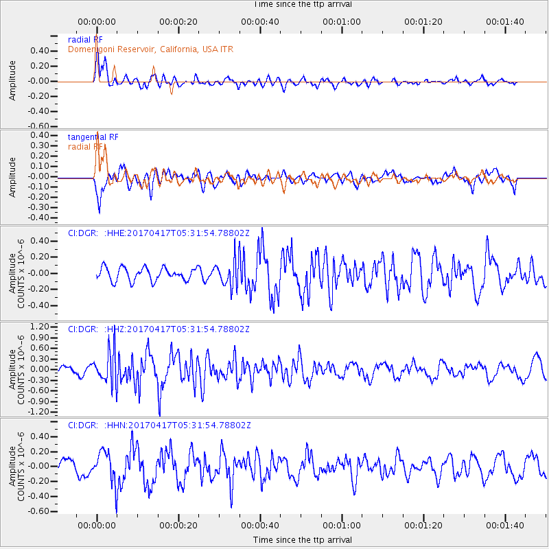
DGR Domenigoni Reservoir, California, USA - Earthquake Result Viewer
*The percent match for this event was below the threshold and hence no stack was calculated.
| Earthquake location: |
Leeward Islands |
| Earthquake latitude/longitude: |
17.5/-61.1 |
| Earthquake time(UTC): |
2017/04/17 (107) 05:23:15 GMT |
| Earthquake Depth: |
21 km |
| Earthquake Magnitude: |
5.6 Mww |
| Earthquake Catalog/Contributor: |
NEIC PDE/us |
|
| Network: |
CI Caltech Regional Seismic Network |
| Station: |
DGR Domenigoni Reservoir, California, USA |
| Lat/Lon: |
33.65 N/117.01 W |
| Elevation: |
609 m |
|
| Distance: |
52.3 deg |
| Az: |
299.251 deg |
| Baz: |
93.359 deg |
| Ray Param: |
$rayparam |
*The percent match for this event was below the threshold and hence was not used in the summary stack. |
|
| Radial Match: |
72.32439 % |
| Radial Bump: |
400 |
| Transverse Match: |
49.631622 % |
| Transverse Bump: |
400 |
| SOD ConfigId: |
11737051 |
| Insert Time: |
2019-04-27 03:14:18.096 +0000 |
| GWidth: |
2.5 |
| Max Bumps: |
400 |
| Tol: |
0.001 |
|
Signal To Noise
| Channel | StoN | STA | LTA |
| CI:DGR: :HHZ:20170417T05:31:54.78802Z | 5.4687066 | 4.573102E-7 | 8.36231E-8 |
| CI:DGR: :HHN:20170417T05:31:54.78802Z | 2.3653095 | 2.1212335E-7 | 8.9681016E-8 |
| CI:DGR: :HHE:20170417T05:31:54.78802Z | 2.0330749 | 1.6293275E-7 | 8.014105E-8 |
| Arrivals |
| Ps | |
| PpPs | |
| PsPs/PpSs | |


