You are here: Home > Network List > CI - Caltech Regional Seismic Network Stations List
> Station SMM Simmler, CA, USA > Earthquake Result Viewer
SMM Simmler, CA, USA - Earthquake Result Viewer
*The percent match for this event was below the threshold and hence no stack was calculated.
| Earthquake location: |
Leeward Islands |
| Earthquake latitude/longitude: |
17.5/-61.1 |
| Earthquake time(UTC): |
2017/04/17 (107) 05:23:15 GMT |
| Earthquake Depth: |
21 km |
| Earthquake Magnitude: |
5.6 Mww |
| Earthquake Catalog/Contributor: |
NEIC PDE/us |
|
| Network: |
CI Caltech Regional Seismic Network |
| Station: |
SMM Simmler, CA, USA |
| Lat/Lon: |
35.31 N/120.00 W |
| Elevation: |
599 m |
|
| Distance: |
54.9 deg |
| Az: |
301.146 deg |
| Baz: |
92.801 deg |
| Ray Param: |
$rayparam |
*The percent match for this event was below the threshold and hence was not used in the summary stack. |
|
| Radial Match: |
74.74885 % |
| Radial Bump: |
400 |
| Transverse Match: |
76.11915 % |
| Transverse Bump: |
400 |
| SOD ConfigId: |
11737051 |
| Insert Time: |
2019-04-27 03:14:37.430 +0000 |
| GWidth: |
2.5 |
| Max Bumps: |
400 |
| Tol: |
0.001 |
|
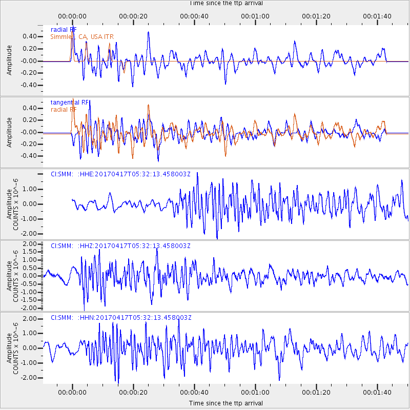
Signal To Noise
| Channel | StoN | STA | LTA |
| CI:SMM: :HHZ:20170417T05:32:13.458003Z | 2.4640272 | 6.5521004E-7 | 2.6591024E-7 |
| CI:SMM: :HHN:20170417T05:32:13.458003Z | 1.009903 | 3.458576E-7 | 3.4246614E-7 |
| CI:SMM: :HHE:20170417T05:32:13.458003Z | 1.3368196 | 3.3842974E-7 | 2.5316035E-7 |
| Arrivals |
| Ps | |
| PpPs | |
| PsPs/PpSs | |


