
V29A Stinnett, TX, USA - Earthquake Result Viewer
| ||||||||||||||||||
| ||||||||||||||||||
| ||||||||||||||||||
|
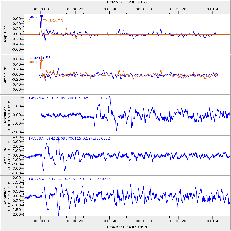
Signal To Noise
| Channel | StoN | STA | LTA |
| TA:V29A: :BHZ:20090706T15:02:34.325022Z | 9.049846 | 1.6664129E-6 | 1.8413716E-7 |
| TA:V29A: :BHN:20090706T15:02:34.325022Z | 5.3586903 | 7.8059327E-7 | 1.4566868E-7 |
| TA:V29A: :BHE:20090706T15:02:34.325022Z | 6.716604 | 8.156841E-7 | 1.2144292E-7 |
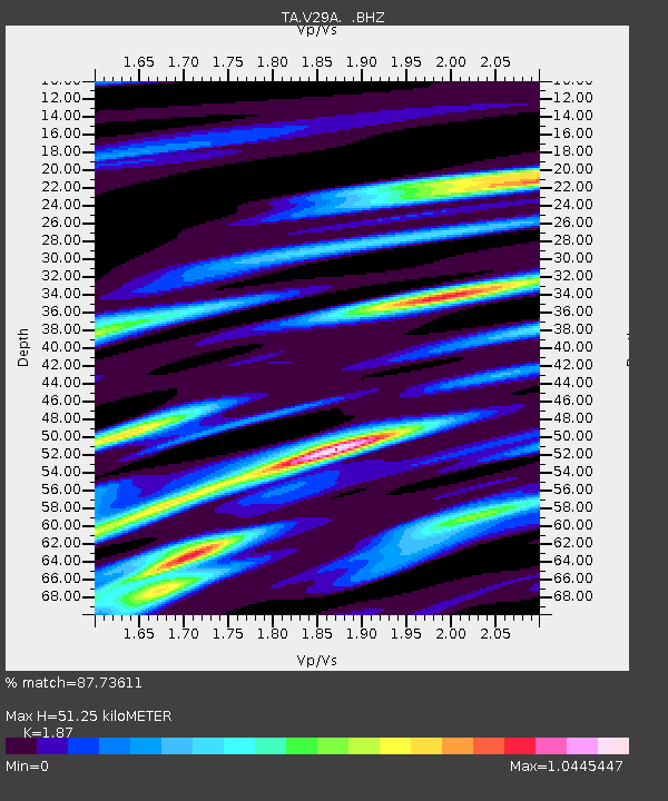
| Arrivals | |
| Ps | 7.3 SECOND |
| PpPs | 22 SECOND |
| PsPs/PpSs | 29 SECOND |

