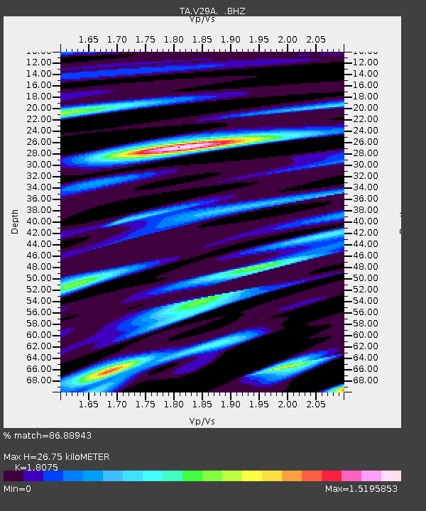
V29A Stinnett, TX, USA - Earthquake Result Viewer
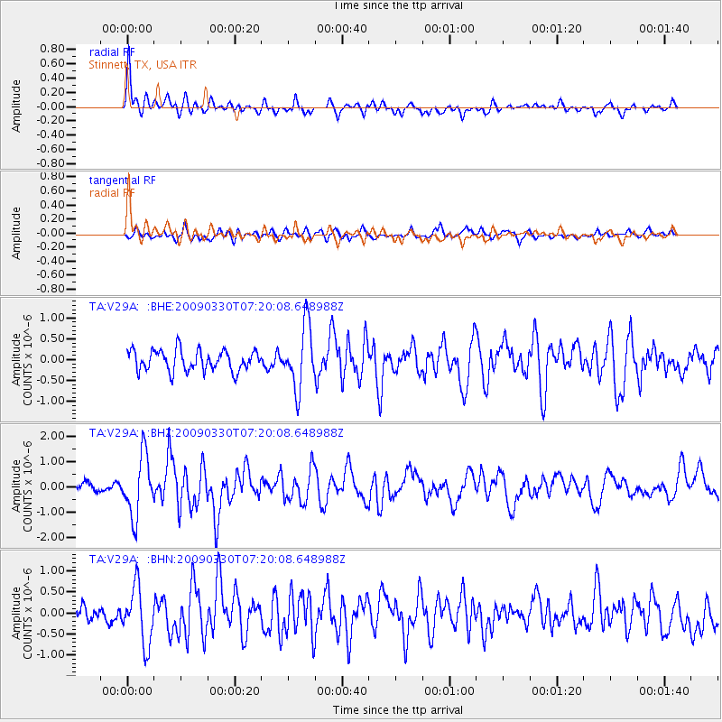
Earthquake location: Kodiak Island Region, Alaska
Earthquake latitude/longitude: 56.5/-152.7
Earthquake time(UTC): 2009/03/30 (089) 07:13:07 GMT
Earthquake Depth: 21 km
Earthquake Magnitude: 5.9 MB, 5.9 MS, 5.9 MW, 5.9 MW
Earthquake Catalog/Contributor: WHDF/NEIC
Network: TA USArray Transportable Network (new EarthScope stations)
Station: V29A Stinnett, TX, USA
Lat/Lon: 35.87 N/101.52 W
Elevation: 953 m
Distance: 39.9 deg
Az: 99.011 deg
Baz: 317.661 deg
Ray Param: 0.074699745
Estimated Moho Depth: 26.75 km
Estimated Crust Vp/Vs: 1.81
Assumed Crust Vp: 6.426 km/s
Estimated Crust Vs: 3.555 km/s
Estimated Crust Poisson's Ratio: 0.28
Radial Match: 86.88943 %
Radial Bump: 400
Transverse Match: 68.689926 %
Transverse Bump: 400
SOD ConfigId: 2658
Insert Time: 2010-03-05 23:05:19.437 +0000
GWidth: 2.5
Max Bumps: 400
Tol: 0.001

Signal To Noise

ChannelStoNSTALTA
TA:V29A: :BHZ:20090330T07:20:08.648988Z7.1063411.2080202E-61.6999188E-7
TA:V29A: :BHN:20090330T07:20:08.648988Z3.92905956.8141304E-71.7342906E-7
TA:V29A: :BHE:20090330T07:20:08.648988Z3.05528647.5155594E-72.4598543E-7
Arrivals
Ps3.6 SECOND
PpPs11 SECOND
PsPs/PpSs15 SECOND