You are here: Home > Network List > TA - USArray Transportable Network (new EarthScope stations) Stations List
> Station V29A Stinnett, TX, USA > Earthquake Result Viewer
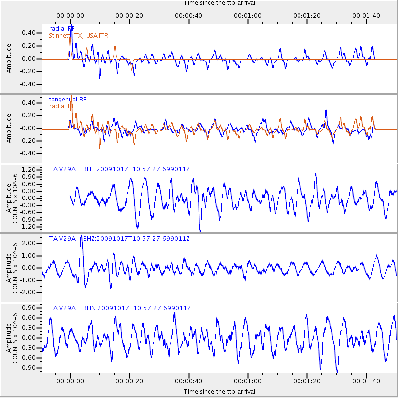
V29A Stinnett, TX, USA - Earthquake Result Viewer
*The percent match for this event was below the threshold and hence no stack was calculated.
| Earthquake location: |
Samoa Islands Region |
| Earthquake latitude/longitude: |
-16.4/-172.0 |
| Earthquake time(UTC): |
2009/10/17 (290) 10:45:26 GMT |
| Earthquake Depth: |
10 km |
| Earthquake Magnitude: |
5.7 MB, 5.3 MS, 5.7 MW, 5.7 MW |
| Earthquake Catalog/Contributor: |
WHDF/NEIC |
|
| Network: |
TA USArray Transportable Network (new EarthScope stations) |
| Station: |
V29A Stinnett, TX, USA |
| Lat/Lon: |
35.87 N/101.52 W |
| Elevation: |
953 m |
|
| Distance: |
84.4 deg |
| Az: |
50.272 deg |
| Baz: |
245.375 deg |
| Ray Param: |
$rayparam |
*The percent match for this event was below the threshold and hence was not used in the summary stack. |
|
| Radial Match: |
58.022057 % |
| Radial Bump: |
400 |
| Transverse Match: |
42.325924 % |
| Transverse Bump: |
371 |
| SOD ConfigId: |
2622 |
| Insert Time: |
2010-03-05 23:05:35.497 +0000 |
| GWidth: |
2.5 |
| Max Bumps: |
400 |
| Tol: |
0.001 |
|
Signal To Noise
| Channel | StoN | STA | LTA |
| TA:V29A: :BHZ:20091017T10:57:27.699011Z | 4.4152617 | 1.1162082E-6 | 2.5280679E-7 |
| TA:V29A: :BHN:20091017T10:57:27.699011Z | 0.48197117 | 1.9394443E-7 | 4.023984E-7 |
| TA:V29A: :BHE:20091017T10:57:27.699011Z | 1.0554917 | 4.2976086E-7 | 4.0716648E-7 |
| Arrivals |
| Ps | |
| PpPs | |
| PsPs/PpSs | |


