You are here: Home > Network List > TA - USArray Transportable Network (new EarthScope stations) Stations List
> Station G21K Allakaket, AK, USA > Earthquake Result Viewer
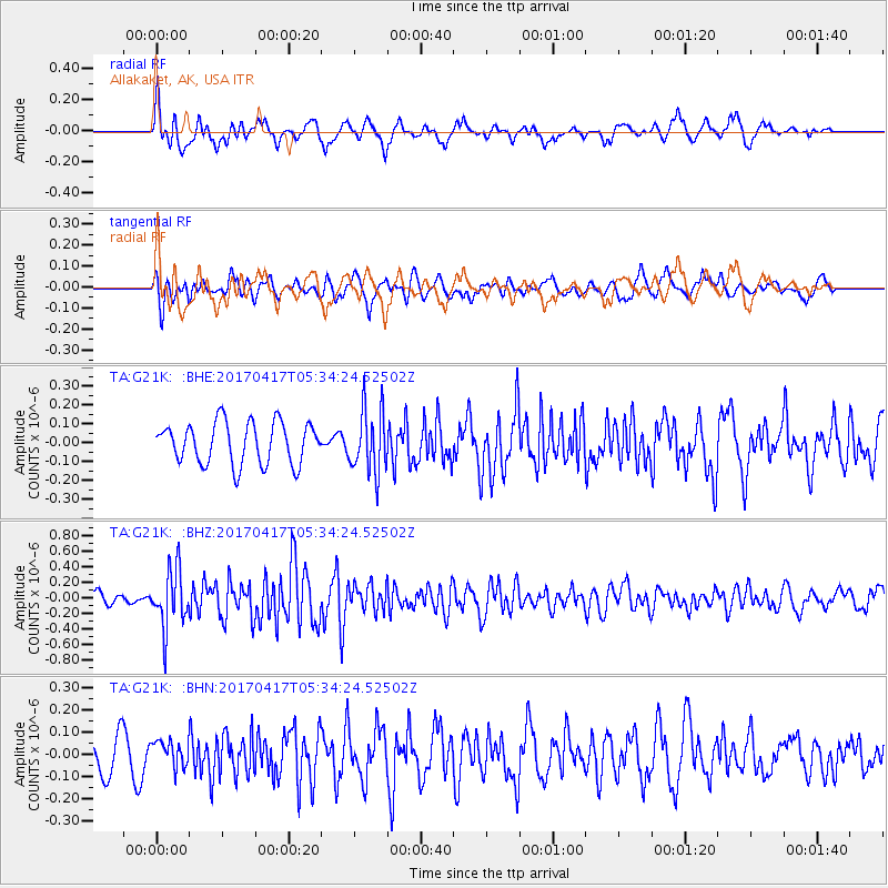
G21K Allakaket, AK, USA - Earthquake Result Viewer
*The percent match for this event was below the threshold and hence no stack was calculated.
| Earthquake location: |
Leeward Islands |
| Earthquake latitude/longitude: |
17.5/-61.1 |
| Earthquake time(UTC): |
2017/04/17 (107) 05:23:15 GMT |
| Earthquake Depth: |
21 km |
| Earthquake Magnitude: |
5.6 Mww |
| Earthquake Catalog/Contributor: |
NEIC PDE/us |
|
| Network: |
TA USArray Transportable Network (new EarthScope stations) |
| Station: |
G21K Allakaket, AK, USA |
| Lat/Lon: |
66.52 N/153.51 W |
| Elevation: |
446 m |
|
| Distance: |
75.1 deg |
| Az: |
335.518 deg |
| Baz: |
80.725 deg |
| Ray Param: |
$rayparam |
*The percent match for this event was below the threshold and hence was not used in the summary stack. |
|
| Radial Match: |
72.96411 % |
| Radial Bump: |
394 |
| Transverse Match: |
61.221416 % |
| Transverse Bump: |
400 |
| SOD ConfigId: |
11737051 |
| Insert Time: |
2019-04-27 03:19:38.602 +0000 |
| GWidth: |
2.5 |
| Max Bumps: |
400 |
| Tol: |
0.001 |
|
Signal To Noise
| Channel | StoN | STA | LTA |
| TA:G21K: :BHZ:20170417T05:34:24.52502Z | 5.968318 | 3.6903376E-7 | 6.183212E-8 |
| TA:G21K: :BHN:20170417T05:34:24.52502Z | 0.9044656 | 5.8581833E-8 | 6.476955E-8 |
| TA:G21K: :BHE:20170417T05:34:24.52502Z | 1.5355027 | 1.6843437E-7 | 1.0969332E-7 |
| Arrivals |
| Ps | |
| PpPs | |
| PsPs/PpSs | |


