You are here: Home > Network List > TA - USArray Transportable Network (new EarthScope stations) Stations List
> Station J26L Joseph Creek, AK, USA > Earthquake Result Viewer
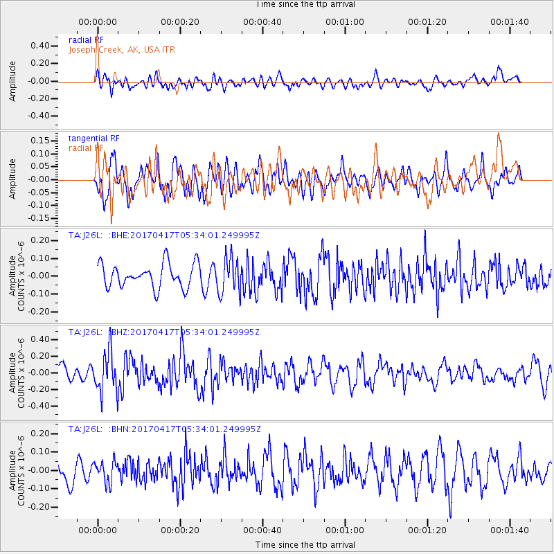
J26L Joseph Creek, AK, USA - Earthquake Result Viewer
*The percent match for this event was below the threshold and hence no stack was calculated.
| Earthquake location: |
Leeward Islands |
| Earthquake latitude/longitude: |
17.5/-61.1 |
| Earthquake time(UTC): |
2017/04/17 (107) 05:23:15 GMT |
| Earthquake Depth: |
21 km |
| Earthquake Magnitude: |
5.6 Mww |
| Earthquake Catalog/Contributor: |
NEIC PDE/us |
|
| Network: |
TA USArray Transportable Network (new EarthScope stations) |
| Station: |
J26L Joseph Creek, AK, USA |
| Lat/Lon: |
64.50 N/143.56 W |
| Elevation: |
1144 m |
|
| Distance: |
71.1 deg |
| Az: |
333.034 deg |
| Baz: |
89.045 deg |
| Ray Param: |
$rayparam |
*The percent match for this event was below the threshold and hence was not used in the summary stack. |
|
| Radial Match: |
52.414326 % |
| Radial Bump: |
400 |
| Transverse Match: |
67.44485 % |
| Transverse Bump: |
400 |
| SOD ConfigId: |
11737051 |
| Insert Time: |
2019-04-27 03:19:48.531 +0000 |
| GWidth: |
2.5 |
| Max Bumps: |
400 |
| Tol: |
0.001 |
|
Signal To Noise
| Channel | StoN | STA | LTA |
| TA:J26L: :BHZ:20170417T05:34:01.249995Z | 2.3737 | 2.5087684E-7 | 1.0569021E-7 |
| TA:J26L: :BHN:20170417T05:34:01.249995Z | 1.0970545 | 5.7776752E-8 | 5.2665342E-8 |
| TA:J26L: :BHE:20170417T05:34:01.249995Z | 1.5018467 | 1.00299516E-7 | 6.6784125E-8 |
| Arrivals |
| Ps | |
| PpPs | |
| PsPs/PpSs | |


