You are here: Home > Network List > TA - USArray Transportable Network (new EarthScope stations) Stations List
> Station L44A Lake County Forest Preserve, Grayslake, IL, USA > Earthquake Result Viewer
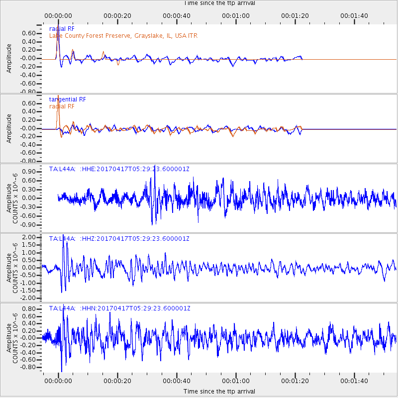
L44A Lake County Forest Preserve, Grayslake, IL, USA - Earthquake Result Viewer
*The percent match for this event was below the threshold and hence no stack was calculated.
| Earthquake location: |
Leeward Islands |
| Earthquake latitude/longitude: |
17.5/-61.1 |
| Earthquake time(UTC): |
2017/04/17 (107) 05:23:15 GMT |
| Earthquake Depth: |
21 km |
| Earthquake Magnitude: |
5.6 Mww |
| Earthquake Catalog/Contributor: |
NEIC PDE/us |
|
| Network: |
TA USArray Transportable Network (new EarthScope stations) |
| Station: |
L44A Lake County Forest Preserve, Grayslake, IL, USA |
| Lat/Lon: |
42.18 N/87.91 W |
| Elevation: |
202 m |
|
| Distance: |
33.6 deg |
| Az: |
322.755 deg |
| Baz: |
129.001 deg |
| Ray Param: |
$rayparam |
*The percent match for this event was below the threshold and hence was not used in the summary stack. |
|
| Radial Match: |
67.93835 % |
| Radial Bump: |
301 |
| Transverse Match: |
56.711758 % |
| Transverse Bump: |
381 |
| SOD ConfigId: |
11737051 |
| Insert Time: |
2019-04-27 03:19:57.315 +0000 |
| GWidth: |
2.5 |
| Max Bumps: |
400 |
| Tol: |
0.001 |
|
Signal To Noise
| Channel | StoN | STA | LTA |
| TA:L44A: :HHZ:20170417T05:29:23.600001Z | 6.7051244 | 8.6790993E-7 | 1.294398E-7 |
| TA:L44A: :HHN:20170417T05:29:23.600001Z | 3.0349042 | 3.5538432E-7 | 1.1709903E-7 |
| TA:L44A: :HHE:20170417T05:29:23.600001Z | 3.1733036 | 4.321762E-7 | 1.3619126E-7 |
| Arrivals |
| Ps | |
| PpPs | |
| PsPs/PpSs | |


