You are here: Home > Network List > TA - USArray Transportable Network (new EarthScope stations) Stations List
> Station R33M Jennings River, BC, CAN > Earthquake Result Viewer
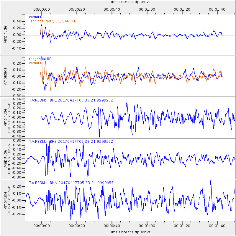
R33M Jennings River, BC, CAN - Earthquake Result Viewer
*The percent match for this event was below the threshold and hence no stack was calculated.
| Earthquake location: |
Leeward Islands |
| Earthquake latitude/longitude: |
17.5/-61.1 |
| Earthquake time(UTC): |
2017/04/17 (107) 05:23:15 GMT |
| Earthquake Depth: |
21 km |
| Earthquake Magnitude: |
5.6 Mww |
| Earthquake Catalog/Contributor: |
NEIC PDE/us |
|
| Network: |
TA USArray Transportable Network (new EarthScope stations) |
| Station: |
R33M Jennings River, BC, CAN |
| Lat/Lon: |
59.39 N/130.97 W |
| Elevation: |
1437 m |
|
| Distance: |
64.9 deg |
| Az: |
327.959 deg |
| Baz: |
98.26 deg |
| Ray Param: |
$rayparam |
*The percent match for this event was below the threshold and hence was not used in the summary stack. |
|
| Radial Match: |
60.77953 % |
| Radial Bump: |
400 |
| Transverse Match: |
65.7507 % |
| Transverse Bump: |
400 |
| SOD ConfigId: |
11737051 |
| Insert Time: |
2019-04-27 03:20:24.061 +0000 |
| GWidth: |
2.5 |
| Max Bumps: |
400 |
| Tol: |
0.001 |
|
Signal To Noise
| Channel | StoN | STA | LTA |
| TA:R33M: :BHZ:20170417T05:33:21.999995Z | 5.109805 | 3.7538086E-7 | 7.346285E-8 |
| TA:R33M: :BHN:20170417T05:33:21.999995Z | 1.3431193 | 8.782989E-8 | 6.539247E-8 |
| TA:R33M: :BHE:20170417T05:33:21.999995Z | 2.179647 | 1.6831765E-7 | 7.7222445E-8 |
| Arrivals |
| Ps | |
| PpPs | |
| PsPs/PpSs | |


