You are here: Home > Network List > UW - Pacific Northwest Regional Seismic Network Stations List
> Station WOLL Wollman Farm, Schrag, WA, USA > Earthquake Result Viewer
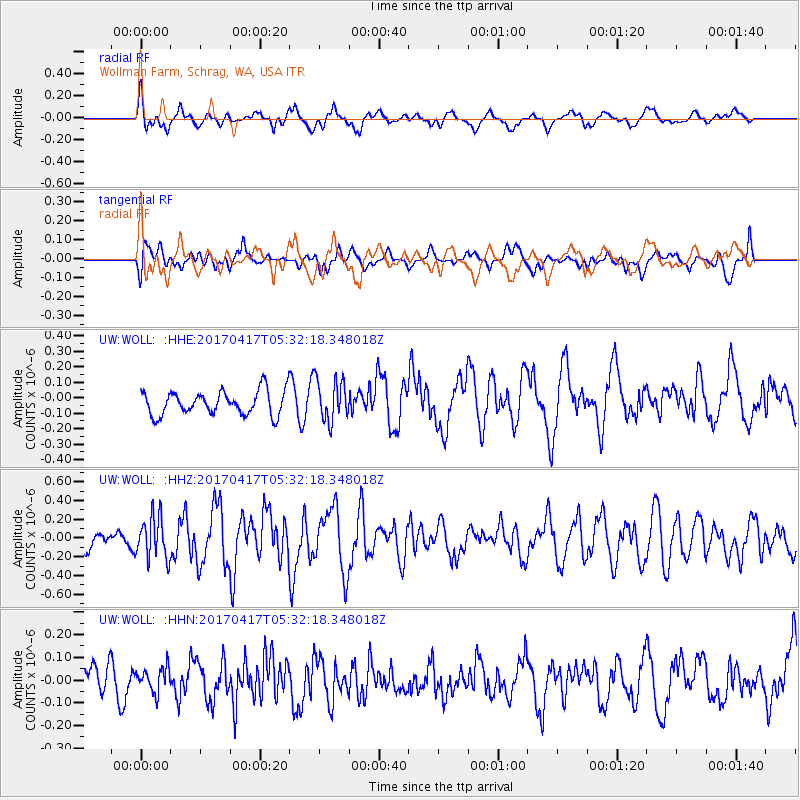
WOLL Wollman Farm, Schrag, WA, USA - Earthquake Result Viewer
*The percent match for this event was below the threshold and hence no stack was calculated.
| Earthquake location: |
Leeward Islands |
| Earthquake latitude/longitude: |
17.5/-61.1 |
| Earthquake time(UTC): |
2017/04/17 (107) 05:23:15 GMT |
| Earthquake Depth: |
21 km |
| Earthquake Magnitude: |
5.6 Mww |
| Earthquake Catalog/Contributor: |
NEIC PDE/us |
|
| Network: |
UW Pacific Northwest Regional Seismic Network |
| Station: |
WOLL Wollman Farm, Schrag, WA, USA |
| Lat/Lon: |
47.06 N/118.92 W |
| Elevation: |
385 m |
|
| Distance: |
55.5 deg |
| Az: |
315.454 deg |
| Baz: |
101.702 deg |
| Ray Param: |
$rayparam |
*The percent match for this event was below the threshold and hence was not used in the summary stack. |
|
| Radial Match: |
51.85056 % |
| Radial Bump: |
400 |
| Transverse Match: |
59.33268 % |
| Transverse Bump: |
400 |
| SOD ConfigId: |
11737051 |
| Insert Time: |
2019-04-27 03:21:11.294 +0000 |
| GWidth: |
2.5 |
| Max Bumps: |
400 |
| Tol: |
0.001 |
|
Signal To Noise
| Channel | StoN | STA | LTA |
| UW:WOLL: :HHZ:20170417T05:32:18.348018Z | 1.946348 | 2.234465E-7 | 1.1480296E-7 |
| UW:WOLL: :HHN:20170417T05:32:18.348018Z | 0.66267186 | 5.446832E-8 | 8.219501E-8 |
| UW:WOLL: :HHE:20170417T05:32:18.348018Z | 1.7575319 | 1.363814E-7 | 7.759825E-8 |
| Arrivals |
| Ps | |
| PpPs | |
| PsPs/PpSs | |


