
W28A Vega, TX, USA - Earthquake Result Viewer
| ||||||||||||||||||
| ||||||||||||||||||
| ||||||||||||||||||
|
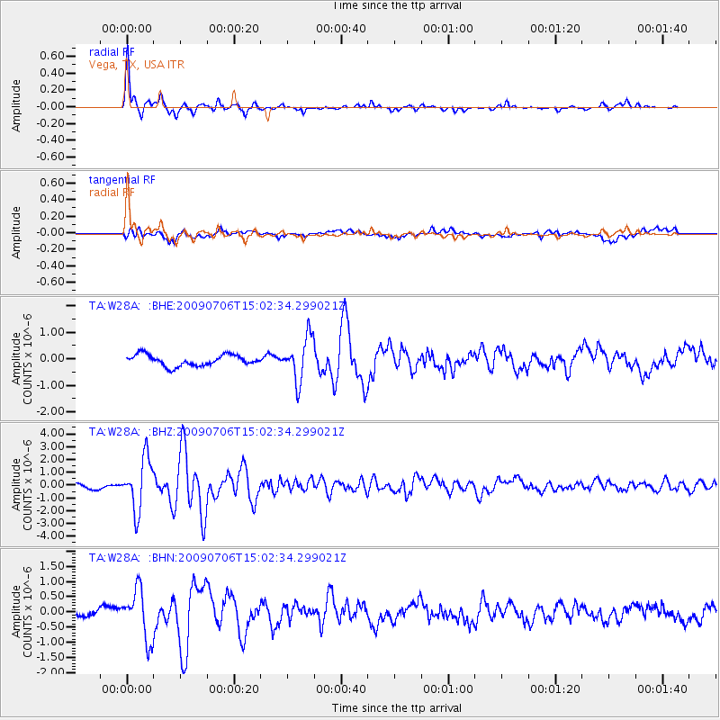
Signal To Noise
| Channel | StoN | STA | LTA |
| TA:W28A: :BHZ:20090706T15:02:34.299021Z | 11.008576 | 2.0460573E-6 | 1.8586029E-7 |
| TA:W28A: :BHN:20090706T15:02:34.299021Z | 4.0451264 | 8.2715377E-7 | 2.0448155E-7 |
| TA:W28A: :BHE:20090706T15:02:34.299021Z | 4.012703 | 8.2886567E-7 | 2.0656044E-7 |
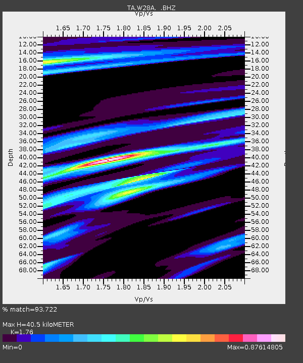
| Arrivals | |
| Ps | 5.2 SECOND |
| PpPs | 17 SECOND |
| PsPs/PpSs | 22 SECOND |

