You are here: Home > Network List > TA - USArray Transportable Network (new EarthScope stations) Stations List
> Station W28A Vega, TX, USA > Earthquake Result Viewer
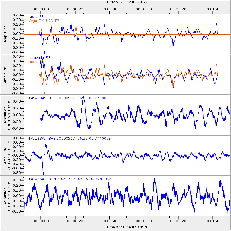
W28A Vega, TX, USA - Earthquake Result Viewer
*The percent match for this event was below the threshold and hence no stack was calculated.
| Earthquake location: |
Tonga Islands |
| Earthquake latitude/longitude: |
-16.8/-173.5 |
| Earthquake time(UTC): |
2009/05/17 (137) 06:23:03 GMT |
| Earthquake Depth: |
67 km |
| Earthquake Magnitude: |
5.5 MB, 5.6 MW, 5.6 MW |
| Earthquake Catalog/Contributor: |
WHDF/NEIC |
|
| Network: |
TA USArray Transportable Network (new EarthScope stations) |
| Station: |
W28A Vega, TX, USA |
| Lat/Lon: |
35.26 N/102.21 W |
| Elevation: |
1156 m |
|
| Distance: |
85.1 deg |
| Az: |
51.079 deg |
| Baz: |
245.571 deg |
| Ray Param: |
$rayparam |
*The percent match for this event was below the threshold and hence was not used in the summary stack. |
|
| Radial Match: |
71.32638 % |
| Radial Bump: |
400 |
| Transverse Match: |
60.900543 % |
| Transverse Bump: |
400 |
| SOD ConfigId: |
2760 |
| Insert Time: |
2010-03-05 23:06:35.020 +0000 |
| GWidth: |
2.5 |
| Max Bumps: |
400 |
| Tol: |
0.001 |
|
Signal To Noise
| Channel | StoN | STA | LTA |
| TA:W28A: :BHZ:20090517T06:35:00.774009Z | 1.6760098 | 3.52186E-7 | 2.1013362E-7 |
| TA:W28A: :BHN:20090517T06:35:00.774009Z | 0.76786655 | 1.3470076E-7 | 1.7542209E-7 |
| TA:W28A: :BHE:20090517T06:35:00.774009Z | 1.4934942 | 2.07231E-7 | 1.3875581E-7 |
| Arrivals |
| Ps | |
| PpPs | |
| PsPs/PpSs | |


