You are here: Home > Network List > TA - USArray Transportable Network (new EarthScope stations) Stations List
> Station W28A Vega, TX, USA > Earthquake Result Viewer
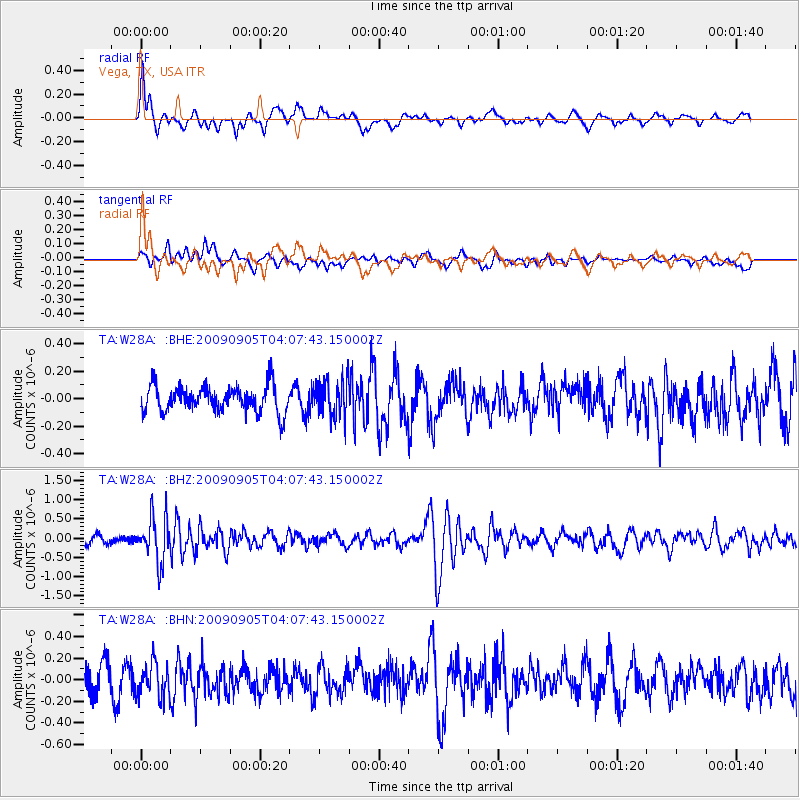
W28A Vega, TX, USA - Earthquake Result Viewer
*The percent match for this event was below the threshold and hence no stack was calculated.
| Earthquake location: |
Southern Peru |
| Earthquake latitude/longitude: |
-15.1/-70.2 |
| Earthquake time(UTC): |
2009/09/05 (248) 03:58:39 GMT |
| Earthquake Depth: |
210 km |
| Earthquake Magnitude: |
5.8 MW, 5.2 MB, 5.8 MW |
| Earthquake Catalog/Contributor: |
WHDF/NEIC |
|
| Network: |
TA USArray Transportable Network (new EarthScope stations) |
| Station: |
W28A Vega, TX, USA |
| Lat/Lon: |
35.26 N/102.21 W |
| Elevation: |
1156 m |
|
| Distance: |
58.6 deg |
| Az: |
329.487 deg |
| Baz: |
143.188 deg |
| Ray Param: |
$rayparam |
*The percent match for this event was below the threshold and hence was not used in the summary stack. |
|
| Radial Match: |
65.278595 % |
| Radial Bump: |
400 |
| Transverse Match: |
53.874065 % |
| Transverse Bump: |
400 |
| SOD ConfigId: |
2622 |
| Insert Time: |
2010-03-05 23:06:40.305 +0000 |
| GWidth: |
2.5 |
| Max Bumps: |
400 |
| Tol: |
0.001 |
|
Signal To Noise
| Channel | StoN | STA | LTA |
| TA:W28A: :BHZ:20090905T04:07:43.150002Z | 4.9948053 | 5.868949E-7 | 1.1750106E-7 |
| TA:W28A: :BHN:20090905T04:07:43.150002Z | 1.3033456 | 1.606941E-7 | 1.2329356E-7 |
| TA:W28A: :BHE:20090905T04:07:43.150002Z | 1.3757411 | 1.3243975E-7 | 9.6267925E-8 |
| Arrivals |
| Ps | |
| PpPs | |
| PsPs/PpSs | |


