You are here: Home > Network List > AV - Alaska Volcano Observatory Stations List
> Station SPCR Ckakachatna River, Mount Spurr, Alaska > Earthquake Result Viewer
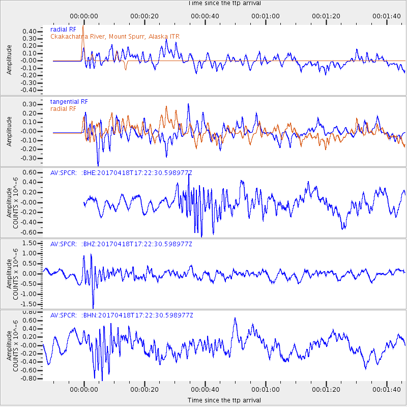
SPCR Ckakachatna River, Mount Spurr, Alaska - Earthquake Result Viewer
*The percent match for this event was below the threshold and hence no stack was calculated.
| Earthquake location: |
Fiji Islands Region |
| Earthquake latitude/longitude: |
-18.1/-178.4 |
| Earthquake time(UTC): |
2017/04/18 (108) 17:11:47 GMT |
| Earthquake Depth: |
626 km |
| Earthquake Magnitude: |
6.0 Mww |
| Earthquake Catalog/Contributor: |
NEIC PDE/us |
|
| Network: |
AV Alaska Volcano Observatory |
| Station: |
SPCR Ckakachatna River, Mount Spurr, Alaska |
| Lat/Lon: |
61.20 N/152.21 W |
| Elevation: |
984 m |
|
| Distance: |
81.7 deg |
| Az: |
12.471 deg |
| Baz: |
205.105 deg |
| Ray Param: |
$rayparam |
*The percent match for this event was below the threshold and hence was not used in the summary stack. |
|
| Radial Match: |
57.854973 % |
| Radial Bump: |
400 |
| Transverse Match: |
63.80313 % |
| Transverse Bump: |
400 |
| SOD ConfigId: |
11737051 |
| Insert Time: |
2019-04-27 03:24:50.040 +0000 |
| GWidth: |
2.5 |
| Max Bumps: |
400 |
| Tol: |
0.001 |
|
Signal To Noise
| Channel | StoN | STA | LTA |
| AV:SPCR: :BHZ:20170418T17:22:30.598977Z | 3.1158087 | 6.0096096E-7 | 1.928748E-7 |
| AV:SPCR: :BHN:20170418T17:22:30.598977Z | 2.1242101 | 2.9994948E-7 | 1.4120518E-7 |
| AV:SPCR: :BHE:20170418T17:22:30.598977Z | 2.0086293 | 2.3065222E-7 | 1.1483065E-7 |
| Arrivals |
| Ps | |
| PpPs | |
| PsPs/PpSs | |


