You are here: Home > Network List > CN - Canadian National Seismograph Network Stations List
> Station INK INUVIK, NT > Earthquake Result Viewer
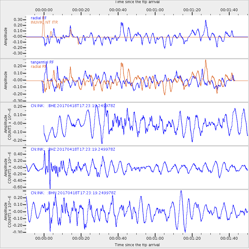
INK INUVIK, NT - Earthquake Result Viewer
*The percent match for this event was below the threshold and hence no stack was calculated.
| Earthquake location: |
Fiji Islands Region |
| Earthquake latitude/longitude: |
-18.1/-178.4 |
| Earthquake time(UTC): |
2017/04/18 (108) 17:11:47 GMT |
| Earthquake Depth: |
626 km |
| Earthquake Magnitude: |
6.0 Mww |
| Earthquake Catalog/Contributor: |
NEIC PDE/us |
|
| Network: |
CN Canadian National Seismograph Network |
| Station: |
INK INUVIK, NT |
| Lat/Lon: |
68.31 N/133.53 W |
| Elevation: |
44 m |
|
| Distance: |
92.0 deg |
| Az: |
15.217 deg |
| Baz: |
222.194 deg |
| Ray Param: |
$rayparam |
*The percent match for this event was below the threshold and hence was not used in the summary stack. |
|
| Radial Match: |
42.074455 % |
| Radial Bump: |
400 |
| Transverse Match: |
47.993393 % |
| Transverse Bump: |
400 |
| SOD ConfigId: |
11737051 |
| Insert Time: |
2019-04-27 03:26:15.461 +0000 |
| GWidth: |
2.5 |
| Max Bumps: |
400 |
| Tol: |
0.001 |
|
Signal To Noise
| Channel | StoN | STA | LTA |
| CN:INK: :BHZ:20170418T17:23:19.249978Z | 2.4768088 | 2.562214E-7 | 1.03448194E-7 |
| CN:INK: :BHN:20170418T17:23:19.249978Z | 0.81843543 | 1.0488339E-7 | 1.2815109E-7 |
| CN:INK: :BHE:20170418T17:23:19.249978Z | 1.4634626 | 1.3835938E-7 | 9.454248E-8 |
| Arrivals |
| Ps | |
| PpPs | |
| PsPs/PpSs | |


