You are here: Home > Network List > IW - Intermountain West Stations List
> Station PLID Pearl Lake, Idaho, USA > Earthquake Result Viewer
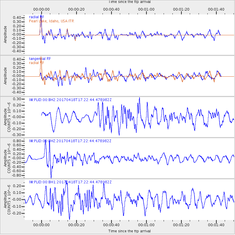
PLID Pearl Lake, Idaho, USA - Earthquake Result Viewer
*The percent match for this event was below the threshold and hence no stack was calculated.
| Earthquake location: |
Fiji Islands Region |
| Earthquake latitude/longitude: |
-18.1/-178.4 |
| Earthquake time(UTC): |
2017/04/18 (108) 17:11:47 GMT |
| Earthquake Depth: |
626 km |
| Earthquake Magnitude: |
6.0 Mww |
| Earthquake Catalog/Contributor: |
NEIC PDE/us |
|
| Network: |
IW Intermountain West |
| Station: |
PLID Pearl Lake, Idaho, USA |
| Lat/Lon: |
45.09 N/116.00 W |
| Elevation: |
2164 m |
|
| Distance: |
84.6 deg |
| Az: |
39.095 deg |
| Baz: |
237.878 deg |
| Ray Param: |
$rayparam |
*The percent match for this event was below the threshold and hence was not used in the summary stack. |
|
| Radial Match: |
66.65638 % |
| Radial Bump: |
400 |
| Transverse Match: |
61.393692 % |
| Transverse Bump: |
400 |
| SOD ConfigId: |
11737051 |
| Insert Time: |
2019-04-27 03:27:06.308 +0000 |
| GWidth: |
2.5 |
| Max Bumps: |
400 |
| Tol: |
0.001 |
|
Signal To Noise
| Channel | StoN | STA | LTA |
| IW:PLID:00:BHZ:20170418T17:22:44.478982Z | 3.7821941 | 3.800321E-7 | 1.0047927E-7 |
| IW:PLID:00:BH1:20170418T17:22:44.478982Z | 1.176847 | 9.1559606E-8 | 7.780077E-8 |
| IW:PLID:00:BH2:20170418T17:22:44.478982Z | 1.4597821 | 1.2479894E-7 | 8.549149E-8 |
| Arrivals |
| Ps | |
| PpPs | |
| PsPs/PpSs | |


