You are here: Home > Network List > TA - USArray Transportable Network (new EarthScope stations) Stations List
> Station J20K Nowitna River, AK, USA > Earthquake Result Viewer
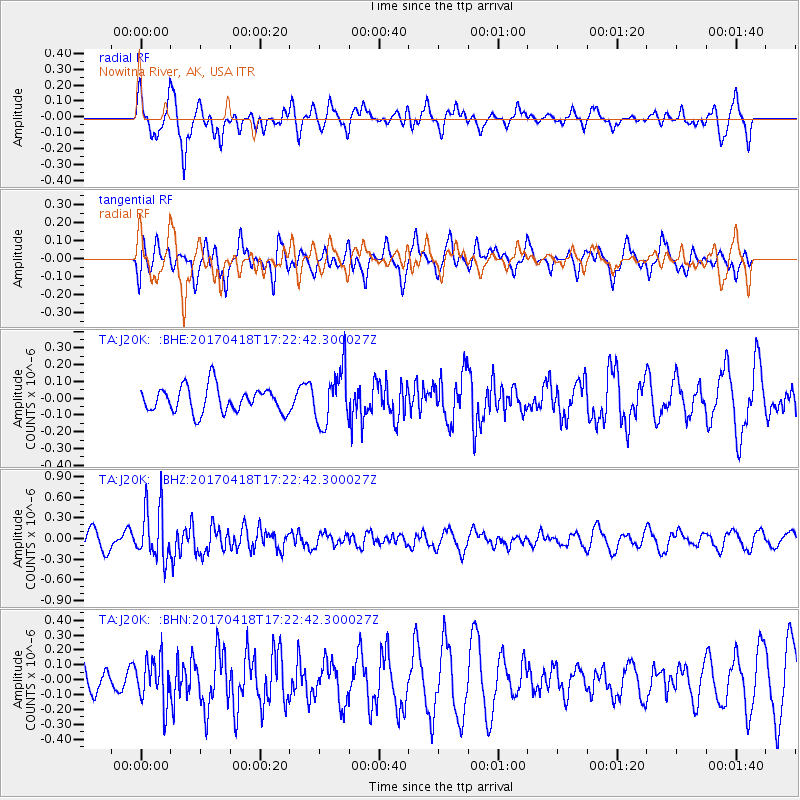
J20K Nowitna River, AK, USA - Earthquake Result Viewer
*The percent match for this event was below the threshold and hence no stack was calculated.
| Earthquake location: |
Fiji Islands Region |
| Earthquake latitude/longitude: |
-18.1/-178.4 |
| Earthquake time(UTC): |
2017/04/18 (108) 17:11:47 GMT |
| Earthquake Depth: |
626 km |
| Earthquake Magnitude: |
6.0 Mww |
| Earthquake Catalog/Contributor: |
NEIC PDE/us |
|
| Network: |
TA USArray Transportable Network (new EarthScope stations) |
| Station: |
J20K Nowitna River, AK, USA |
| Lat/Lon: |
64.18 N/154.15 W |
| Elevation: |
314 m |
|
| Distance: |
84.1 deg |
| Az: |
10.419 deg |
| Baz: |
203.132 deg |
| Ray Param: |
$rayparam |
*The percent match for this event was below the threshold and hence was not used in the summary stack. |
|
| Radial Match: |
47.758987 % |
| Radial Bump: |
363 |
| Transverse Match: |
53.23291 % |
| Transverse Bump: |
382 |
| SOD ConfigId: |
11737051 |
| Insert Time: |
2019-04-27 03:28:59.818 +0000 |
| GWidth: |
2.5 |
| Max Bumps: |
400 |
| Tol: |
0.001 |
|
Signal To Noise
| Channel | StoN | STA | LTA |
| TA:J20K: :BHZ:20170418T17:22:42.300027Z | 3.7186718 | 3.8251204E-7 | 1.0286255E-7 |
| TA:J20K: :BHN:20170418T17:22:42.300027Z | 1.1391529 | 1.4942863E-7 | 1.3117521E-7 |
| TA:J20K: :BHE:20170418T17:22:42.300027Z | 2.132604 | 1.6223386E-7 | 7.607313E-8 |
| Arrivals |
| Ps | |
| PpPs | |
| PsPs/PpSs | |


