You are here: Home > Network List > TA - USArray Transportable Network (new EarthScope stations) Stations List
> Station J26L Joseph Creek, AK, USA > Earthquake Result Viewer
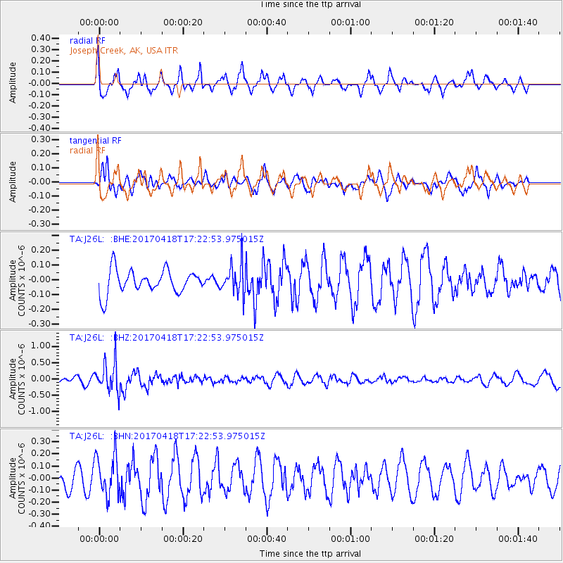
J26L Joseph Creek, AK, USA - Earthquake Result Viewer
*The percent match for this event was below the threshold and hence no stack was calculated.
| Earthquake location: |
Fiji Islands Region |
| Earthquake latitude/longitude: |
-18.1/-178.4 |
| Earthquake time(UTC): |
2017/04/18 (108) 17:11:47 GMT |
| Earthquake Depth: |
626 km |
| Earthquake Magnitude: |
6.0 Mww |
| Earthquake Catalog/Contributor: |
NEIC PDE/us |
|
| Network: |
TA USArray Transportable Network (new EarthScope stations) |
| Station: |
J26L Joseph Creek, AK, USA |
| Lat/Lon: |
64.50 N/143.56 W |
| Elevation: |
1144 m |
|
| Distance: |
86.5 deg |
| Az: |
14.341 deg |
| Baz: |
212.985 deg |
| Ray Param: |
$rayparam |
*The percent match for this event was below the threshold and hence was not used in the summary stack. |
|
| Radial Match: |
69.014915 % |
| Radial Bump: |
368 |
| Transverse Match: |
56.948368 % |
| Transverse Bump: |
377 |
| SOD ConfigId: |
11737051 |
| Insert Time: |
2019-04-27 03:29:02.254 +0000 |
| GWidth: |
2.5 |
| Max Bumps: |
400 |
| Tol: |
0.001 |
|
Signal To Noise
| Channel | StoN | STA | LTA |
| TA:J26L: :BHZ:20170418T17:22:53.975015Z | 5.031679 | 4.7165594E-7 | 9.3737285E-8 |
| TA:J26L: :BHN:20170418T17:22:53.975015Z | 1.6033385 | 1.6801111E-7 | 1.047883E-7 |
| TA:J26L: :BHE:20170418T17:22:53.975015Z | 1.3736832 | 1.0867743E-7 | 7.9113896E-8 |
| Arrivals |
| Ps | |
| PpPs | |
| PsPs/PpSs | |


