You are here: Home > Network List > TA - USArray Transportable Network (new EarthScope stations) Stations List
> Station N23A Red Feather Lakes, CO, USA > Earthquake Result Viewer
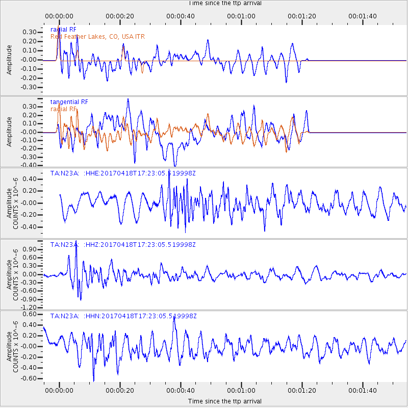
N23A Red Feather Lakes, CO, USA - Earthquake Result Viewer
*The percent match for this event was below the threshold and hence no stack was calculated.
| Earthquake location: |
Fiji Islands Region |
| Earthquake latitude/longitude: |
-18.1/-178.4 |
| Earthquake time(UTC): |
2017/04/18 (108) 17:11:47 GMT |
| Earthquake Depth: |
626 km |
| Earthquake Magnitude: |
6.0 Mww |
| Earthquake Catalog/Contributor: |
NEIC PDE/us |
|
| Network: |
TA USArray Transportable Network (new EarthScope stations) |
| Station: |
N23A Red Feather Lakes, CO, USA |
| Lat/Lon: |
40.89 N/105.94 W |
| Elevation: |
2458 m |
|
| Distance: |
89.0 deg |
| Az: |
46.295 deg |
| Baz: |
245.127 deg |
| Ray Param: |
$rayparam |
*The percent match for this event was below the threshold and hence was not used in the summary stack. |
|
| Radial Match: |
55.540077 % |
| Radial Bump: |
400 |
| Transverse Match: |
50.256966 % |
| Transverse Bump: |
400 |
| SOD ConfigId: |
11737051 |
| Insert Time: |
2019-04-27 03:29:20.273 +0000 |
| GWidth: |
2.5 |
| Max Bumps: |
400 |
| Tol: |
0.001 |
|
Signal To Noise
| Channel | StoN | STA | LTA |
| TA:N23A: :HHZ:20170418T17:23:05.519998Z | 4.568092 | 2.5697025E-7 | 5.6253306E-8 |
| TA:N23A: :HHN:20170418T17:23:05.519998Z | 1.0241259 | 2.0173938E-7 | 1.9698687E-7 |
| TA:N23A: :HHE:20170418T17:23:05.519998Z | 0.9216256 | 1.3044858E-7 | 1.4154183E-7 |
| Arrivals |
| Ps | |
| PpPs | |
| PsPs/PpSs | |


