You are here: Home > Network List > UW - Pacific Northwest Regional Seismic Network Stations List
> Station MRBL Marblemount, WA, USA > Earthquake Result Viewer
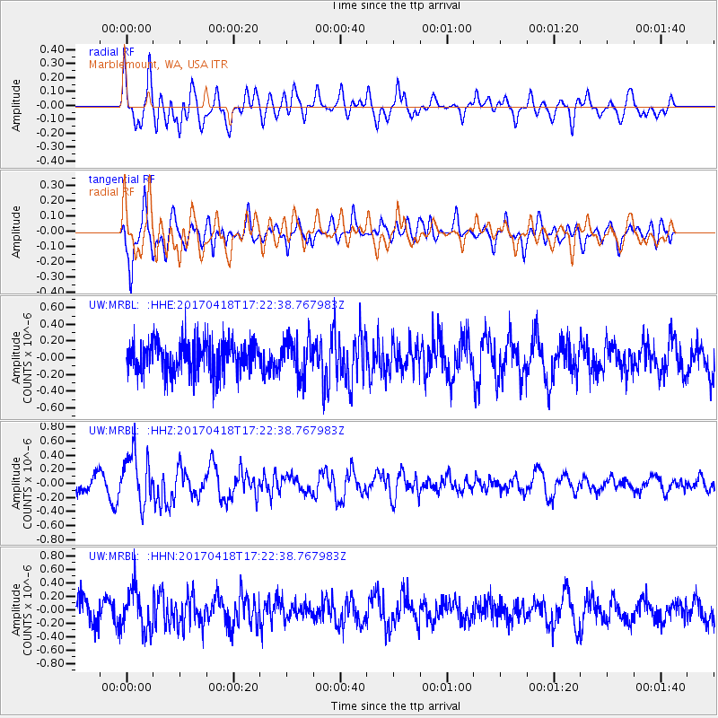
MRBL Marblemount, WA, USA - Earthquake Result Viewer
*The percent match for this event was below the threshold and hence no stack was calculated.
| Earthquake location: |
Fiji Islands Region |
| Earthquake latitude/longitude: |
-18.1/-178.4 |
| Earthquake time(UTC): |
2017/04/18 (108) 17:11:47 GMT |
| Earthquake Depth: |
626 km |
| Earthquake Magnitude: |
6.0 Mww |
| Earthquake Catalog/Contributor: |
NEIC PDE/us |
|
| Network: |
UW Pacific Northwest Regional Seismic Network |
| Station: |
MRBL Marblemount, WA, USA |
| Lat/Lon: |
48.52 N/121.48 W |
| Elevation: |
75 m |
|
| Distance: |
83.4 deg |
| Az: |
34.111 deg |
| Baz: |
233.365 deg |
| Ray Param: |
$rayparam |
*The percent match for this event was below the threshold and hence was not used in the summary stack. |
|
| Radial Match: |
53.81987 % |
| Radial Bump: |
400 |
| Transverse Match: |
63.315155 % |
| Transverse Bump: |
400 |
| SOD ConfigId: |
11737051 |
| Insert Time: |
2019-04-27 03:30:31.943 +0000 |
| GWidth: |
2.5 |
| Max Bumps: |
400 |
| Tol: |
0.001 |
|
Signal To Noise
| Channel | StoN | STA | LTA |
| UW:MRBL: :HHZ:20170418T17:22:38.767983Z | 2.976318 | 3.7177864E-7 | 1.2491228E-7 |
| UW:MRBL: :HHN:20170418T17:22:38.767983Z | 1.6229602 | 3.0740577E-7 | 1.8941054E-7 |
| UW:MRBL: :HHE:20170418T17:22:38.767983Z | 1.1690311 | 2.2559492E-7 | 1.9297596E-7 |
| Arrivals |
| Ps | |
| PpPs | |
| PsPs/PpSs | |


