You are here: Home > Network List > US - United States National Seismic Network Stations List
> Station KSU1 Kansas State University--Konza Prairie, Kansas, USA > Earthquake Result Viewer
KSU1 Kansas State University--Konza Prairie, Kansas, USA - Earthquake Result Viewer

| Earthquake location: |
Peru-Brazil Border Region |
| Earthquake latitude/longitude: |
-10.6/-71.0 |
| Earthquake time(UTC): |
2015/11/24 (328) 22:45:38 GMT |
| Earthquake Depth: |
602 km |
| Earthquake Magnitude: |
7.5 MWW, 6.9 MI |
| Earthquake Catalog/Contributor: |
NEIC PDE/NEIC COMCAT |
|
| Network: |
US United States National Seismic Network |
| Station: |
KSU1 Kansas State University--Konza Prairie, Kansas, USA |
| Lat/Lon: |
39.10 N/96.61 W |
| Elevation: |
347 m |
|
| Distance: |
54.9 deg |
| Az: |
335.694 deg |
| Baz: |
148.661 deg |
| Ray Param: |
0.062529616 |
| Estimated Moho Depth: |
38.25 km |
| Estimated Crust Vp/Vs: |
1.98 |
| Assumed Crust Vp: |
6.483 km/s |
| Estimated Crust Vs: |
3.274 km/s |
| Estimated Crust Poisson's Ratio: |
0.33 |
|
| Radial Match: |
93.75672 % |
| Radial Bump: |
400 |
| Transverse Match: |
85.498215 % |
| Transverse Bump: |
400 |
| SOD ConfigId: |
1259291 |
| Insert Time: |
2015-12-08 23:45:34.964 +0000 |
| GWidth: |
2.5 |
| Max Bumps: |
400 |
| Tol: |
0.001 |
|
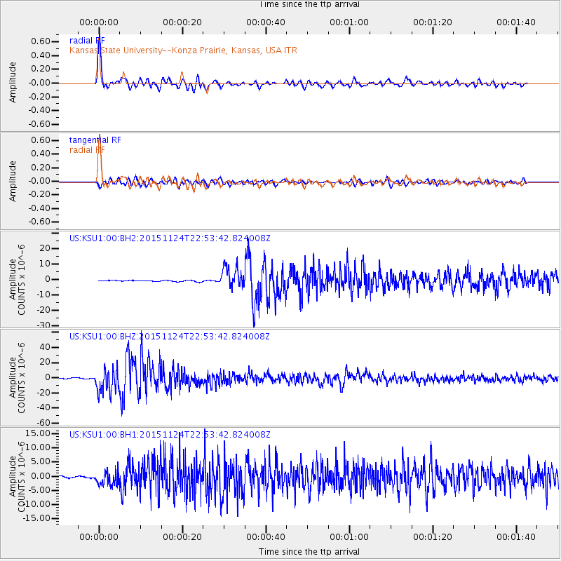
Signal To Noise
| Channel | StoN | STA | LTA |
| US:KSU1:00:BHZ:20151124T22:53:42.824008Z | 34.366028 | 1.5871752E-5 | 4.618442E-7 |
| US:KSU1:00:BH1:20151124T22:53:42.824008Z | 11.859515 | 2.3712516E-6 | 1.9994508E-7 |
| US:KSU1:00:BH2:20151124T22:53:42.824008Z | 18.498207 | 6.7116257E-6 | 3.6282572E-7 |
| Arrivals |
| Ps | 6.0 SECOND |
| PpPs | 17 SECOND |
| PsPs/PpSs | 23 SECOND |


