You are here: Home > Network List > CI - Caltech Regional Seismic Network Stations List
> Station MUR Murrieta > Earthquake Result Viewer
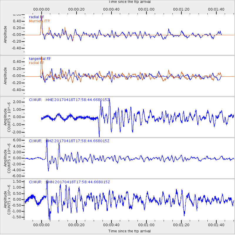
MUR Murrieta - Earthquake Result Viewer
*The percent match for this event was below the threshold and hence no stack was calculated.
| Earthquake location: |
Peru-Ecuador Border Region |
| Earthquake latitude/longitude: |
-2.7/-75.3 |
| Earthquake time(UTC): |
2017/04/18 (108) 17:49:55 GMT |
| Earthquake Depth: |
11 km |
| Earthquake Magnitude: |
6.0 Mww |
| Earthquake Catalog/Contributor: |
NEIC PDE/us |
|
| Network: |
CI Caltech Regional Seismic Network |
| Station: |
MUR Murrieta |
| Lat/Lon: |
33.60 N/117.20 W |
| Elevation: |
562 m |
|
| Distance: |
53.5 deg |
| Az: |
316.122 deg |
| Baz: |
123.95 deg |
| Ray Param: |
$rayparam |
*The percent match for this event was below the threshold and hence was not used in the summary stack. |
|
| Radial Match: |
77.17949 % |
| Radial Bump: |
400 |
| Transverse Match: |
80.73675 % |
| Transverse Bump: |
400 |
| SOD ConfigId: |
11737051 |
| Insert Time: |
2019-04-27 03:36:08.846 +0000 |
| GWidth: |
2.5 |
| Max Bumps: |
400 |
| Tol: |
0.001 |
|
Signal To Noise
| Channel | StoN | STA | LTA |
| CI:MUR: :HHZ:20170418T17:58:44.668015Z | 13.198964 | 2.127381E-6 | 1.6117788E-7 |
| CI:MUR: :HHN:20170418T17:58:44.668015Z | 2.8919075 | 6.952573E-7 | 2.404148E-7 |
| CI:MUR: :HHE:20170418T17:58:44.668015Z | 4.281426 | 9.027664E-7 | 2.1085647E-7 |
| Arrivals |
| Ps | |
| PpPs | |
| PsPs/PpSs | |


