You are here: Home > Network List > GM - US Geological Survey Networks Stations List
> Station IWM01 Jericho 2M Well Monitoring Station > Earthquake Result Viewer
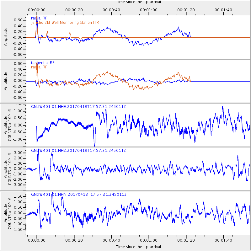
IWM01 Jericho 2M Well Monitoring Station - Earthquake Result Viewer
*The percent match for this event was below the threshold and hence no stack was calculated.
| Earthquake location: |
Peru-Ecuador Border Region |
| Earthquake latitude/longitude: |
-2.7/-75.3 |
| Earthquake time(UTC): |
2017/04/18 (108) 17:49:55 GMT |
| Earthquake Depth: |
11 km |
| Earthquake Magnitude: |
6.0 Mww |
| Earthquake Catalog/Contributor: |
NEIC PDE/us |
|
| Network: |
GM US Geological Survey Networks |
| Station: |
IWM01 Jericho 2M Well Monitoring Station |
| Lat/Lon: |
36.73 N/96.53 W |
| Elevation: |
328 m |
|
| Distance: |
44.0 deg |
| Az: |
335.222 deg |
| Baz: |
148.595 deg |
| Ray Param: |
$rayparam |
*The percent match for this event was below the threshold and hence was not used in the summary stack. |
|
| Radial Match: |
65.42736 % |
| Radial Bump: |
400 |
| Transverse Match: |
25.874626 % |
| Transverse Bump: |
400 |
| SOD ConfigId: |
11737051 |
| Insert Time: |
2019-04-27 03:38:29.695 +0000 |
| GWidth: |
2.5 |
| Max Bumps: |
400 |
| Tol: |
0.001 |
|
Signal To Noise
| Channel | StoN | STA | LTA |
| GM:IWM01:01:HHZ:20170418T17:57:31.245011Z | 14.263379 | 1.5144581E-6 | 1.0617807E-7 |
| GM:IWM01:01:HHN:20170418T17:57:31.245011Z | 1.1957791 | 7.114493E-7 | 5.9496716E-7 |
| GM:IWM01:01:HHE:20170418T17:57:31.245011Z | 1.6465513 | 6.8132726E-7 | 4.1379047E-7 |
| Arrivals |
| Ps | |
| PpPs | |
| PsPs/PpSs | |


