You are here: Home > Network List > TA - USArray Transportable Network (new EarthScope stations) Stations List
> Station R32K Eaglecrest, AK, USA > Earthquake Result Viewer
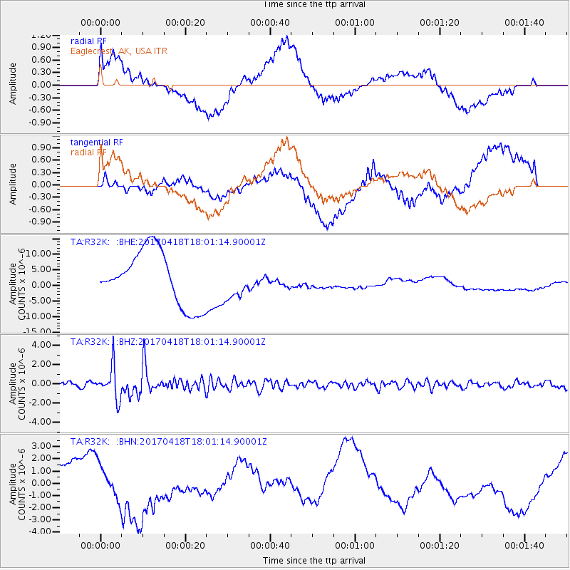
R32K Eaglecrest, AK, USA - Earthquake Result Viewer
*The percent match for this event was below the threshold and hence no stack was calculated.
| Earthquake location: |
Peru-Ecuador Border Region |
| Earthquake latitude/longitude: |
-2.7/-75.3 |
| Earthquake time(UTC): |
2017/04/18 (108) 17:49:55 GMT |
| Earthquake Depth: |
11 km |
| Earthquake Magnitude: |
6.0 Mww |
| Earthquake Catalog/Contributor: |
NEIC PDE/us |
|
| Network: |
TA USArray Transportable Network (new EarthScope stations) |
| Station: |
R32K Eaglecrest, AK, USA |
| Lat/Lon: |
58.27 N/134.52 W |
| Elevation: |
386 m |
|
| Distance: |
76.7 deg |
| Az: |
332.196 deg |
| Baz: |
118.144 deg |
| Ray Param: |
$rayparam |
*The percent match for this event was below the threshold and hence was not used in the summary stack. |
|
| Radial Match: |
5.2934794 % |
| Radial Bump: |
400 |
| Transverse Match: |
12.263035 % |
| Transverse Bump: |
400 |
| SOD ConfigId: |
11737051 |
| Insert Time: |
2019-04-27 03:45:52.116 +0000 |
| GWidth: |
2.5 |
| Max Bumps: |
400 |
| Tol: |
0.001 |
|
Signal To Noise
| Channel | StoN | STA | LTA |
| TA:R32K: :BHZ:20170418T18:01:14.90001Z | 7.0889077 | 1.7391839E-6 | 2.4533875E-7 |
| TA:R32K: :BHN:20170418T18:01:14.90001Z | 0.4780948 | 1.9385188E-6 | 4.0546747E-6 |
| TA:R32K: :BHE:20170418T18:01:14.90001Z | 0.6737173 | 5.806274E-6 | 8.6182645E-6 |
| Arrivals |
| Ps | |
| PpPs | |
| PsPs/PpSs | |


