You are here: Home > Network List > TA - USArray Transportable Network (new EarthScope stations) Stations List
> Station X29A Tulia, tX, USA > Earthquake Result Viewer
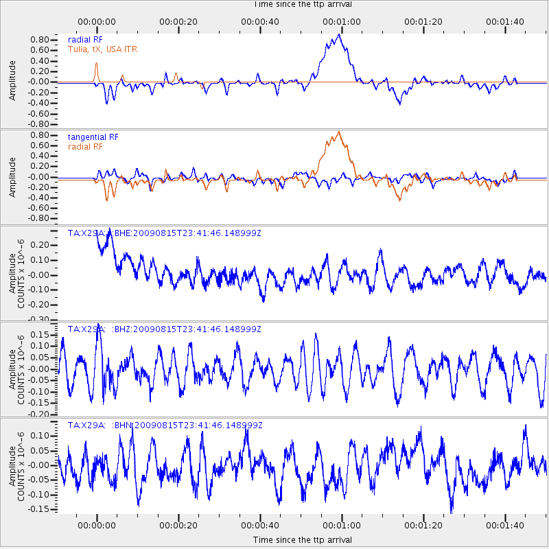
X29A Tulia, tX, USA - Earthquake Result Viewer
*The percent match for this event was below the threshold and hence no stack was calculated.
| Earthquake location: |
Fiji Islands Region |
| Earthquake latitude/longitude: |
-19.8/-178.2 |
| Earthquake time(UTC): |
2009/08/15 (227) 23:30:19 GMT |
| Earthquake Depth: |
608 km |
| Earthquake Magnitude: |
5.6 MW, 5.2 MB |
| Earthquake Catalog/Contributor: |
WHDF/NEIC |
|
| Network: |
TA USArray Transportable Network (new EarthScope stations) |
| Station: |
X29A Tulia, tX, USA |
| Lat/Lon: |
34.45 N/101.70 W |
| Elevation: |
1039 m |
|
| Distance: |
90.5 deg |
| Az: |
53.49 deg |
| Baz: |
246.294 deg |
| Ray Param: |
$rayparam |
*The percent match for this event was below the threshold and hence was not used in the summary stack. |
|
| Radial Match: |
40.109272 % |
| Radial Bump: |
400 |
| Transverse Match: |
43.309456 % |
| Transverse Bump: |
400 |
| SOD ConfigId: |
2622 |
| Insert Time: |
2010-03-05 23:11:39.240 +0000 |
| GWidth: |
2.5 |
| Max Bumps: |
400 |
| Tol: |
0.001 |
|
Signal To Noise
| Channel | StoN | STA | LTA |
| TA:X29A: :BHZ:20090815T23:41:46.148999Z | 1.571378 | 1.02004606E-7 | 6.491411E-8 |
| TA:X29A: :BHN:20090815T23:41:46.148999Z | 0.8880712 | 6.6241626E-8 | 7.4590446E-8 |
| TA:X29A: :BHE:20090815T23:41:46.148999Z | 0.9049397 | 8.427031E-8 | 9.312257E-8 |
| Arrivals |
| Ps | |
| PpPs | |
| PsPs/PpSs | |


