You are here: Home > Network List > UW - Pacific Northwest Regional Seismic Network Stations List
> Station YACT Amboy, WA, USA > Earthquake Result Viewer
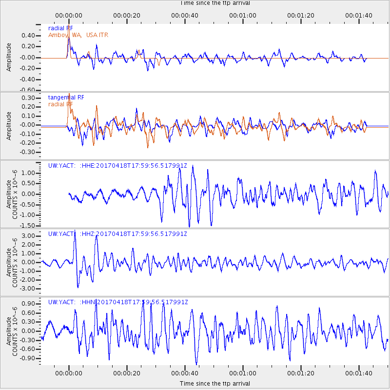
YACT Amboy, WA, USA - Earthquake Result Viewer
*The percent match for this event was below the threshold and hence no stack was calculated.
| Earthquake location: |
Peru-Ecuador Border Region |
| Earthquake latitude/longitude: |
-2.7/-75.3 |
| Earthquake time(UTC): |
2017/04/18 (108) 17:49:55 GMT |
| Earthquake Depth: |
11 km |
| Earthquake Magnitude: |
6.0 Mww |
| Earthquake Catalog/Contributor: |
NEIC PDE/us |
|
| Network: |
UW Pacific Northwest Regional Seismic Network |
| Station: |
YACT Amboy, WA, USA |
| Lat/Lon: |
45.93 N/122.42 W |
| Elevation: |
211 m |
|
| Distance: |
63.9 deg |
| Az: |
325.275 deg |
| Baz: |
125.384 deg |
| Ray Param: |
$rayparam |
*The percent match for this event was below the threshold and hence was not used in the summary stack. |
|
| Radial Match: |
72.019714 % |
| Radial Bump: |
400 |
| Transverse Match: |
73.78234 % |
| Transverse Bump: |
400 |
| SOD ConfigId: |
11737051 |
| Insert Time: |
2019-04-27 03:47:04.871 +0000 |
| GWidth: |
2.5 |
| Max Bumps: |
400 |
| Tol: |
0.001 |
|
Signal To Noise
| Channel | StoN | STA | LTA |
| UW:YACT: :HHZ:20170418T17:59:56.517991Z | 11.308032 | 1.5276987E-6 | 1.3509855E-7 |
| UW:YACT: :HHN:20170418T17:59:56.517991Z | 1.9743123 | 3.3811926E-7 | 1.7125926E-7 |
| UW:YACT: :HHE:20170418T17:59:56.517991Z | 3.2489336 | 5.344652E-7 | 1.6450481E-7 |
| Arrivals |
| Ps | |
| PpPs | |
| PsPs/PpSs | |


