You are here: Home > Network List > CN - Canadian National Seismograph Network Stations List
> Station FRB IQALUIT, N.W.T. > Earthquake Result Viewer
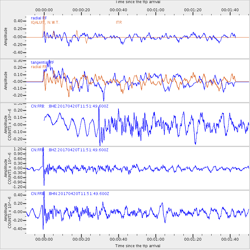
FRB IQALUIT, N.W.T. - Earthquake Result Viewer
*The percent match for this event was below the threshold and hence no stack was calculated.
| Earthquake location: |
Kuril Islands |
| Earthquake latitude/longitude: |
44.4/148.7 |
| Earthquake time(UTC): |
2017/04/20 (110) 11:41:26 GMT |
| Earthquake Depth: |
61 km |
| Earthquake Magnitude: |
5.5 mb |
| Earthquake Catalog/Contributor: |
NEIC PDE/us |
|
| Network: |
CN Canadian National Seismograph Network |
| Station: |
FRB IQALUIT, N.W.T. |
| Lat/Lon: |
63.75 N/68.55 W |
| Elevation: |
18 m |
|
| Distance: |
68.2 deg |
| Az: |
16.864 deg |
| Baz: |
332.137 deg |
| Ray Param: |
$rayparam |
*The percent match for this event was below the threshold and hence was not used in the summary stack. |
|
| Radial Match: |
60.705357 % |
| Radial Bump: |
400 |
| Transverse Match: |
48.252537 % |
| Transverse Bump: |
400 |
| SOD ConfigId: |
11737051 |
| Insert Time: |
2019-04-27 03:52:34.304 +0000 |
| GWidth: |
2.5 |
| Max Bumps: |
400 |
| Tol: |
0.001 |
|
Signal To Noise
| Channel | StoN | STA | LTA |
| CN:FRB: :BHZ:20170420T11:51:49.600Z | 4.1133385 | 3.9962603E-7 | 9.715369E-8 |
| CN:FRB: :BHN:20170420T11:51:49.600Z | 2.7314138 | 1.7152426E-7 | 6.279688E-8 |
| CN:FRB: :BHE:20170420T11:51:49.600Z | 1.8507588 | 1.5736278E-7 | 8.502609E-8 |
| Arrivals |
| Ps | |
| PpPs | |
| PsPs/PpSs | |


