You are here: Home > Network List > CN - Canadian National Seismograph Network Stations List
> Station INK INUVIK, NT > Earthquake Result Viewer
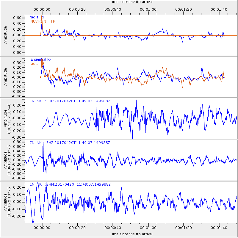
INK INUVIK, NT - Earthquake Result Viewer
*The percent match for this event was below the threshold and hence no stack was calculated.
| Earthquake location: |
Kuril Islands |
| Earthquake latitude/longitude: |
44.4/148.7 |
| Earthquake time(UTC): |
2017/04/20 (110) 11:41:26 GMT |
| Earthquake Depth: |
61 km |
| Earthquake Magnitude: |
5.5 mb |
| Earthquake Catalog/Contributor: |
NEIC PDE/us |
|
| Network: |
CN Canadian National Seismograph Network |
| Station: |
INK INUVIK, NT |
| Lat/Lon: |
68.31 N/133.53 W |
| Elevation: |
44 m |
|
| Distance: |
45.2 deg |
| Az: |
30.776 deg |
| Baz: |
279.58 deg |
| Ray Param: |
$rayparam |
*The percent match for this event was below the threshold and hence was not used in the summary stack. |
|
| Radial Match: |
58.484028 % |
| Radial Bump: |
400 |
| Transverse Match: |
54.492157 % |
| Transverse Bump: |
400 |
| SOD ConfigId: |
11737051 |
| Insert Time: |
2019-04-27 03:52:39.292 +0000 |
| GWidth: |
2.5 |
| Max Bumps: |
400 |
| Tol: |
0.001 |
|
Signal To Noise
| Channel | StoN | STA | LTA |
| CN:INK: :BHZ:20170420T11:49:07.149988Z | 3.1828244 | 3.0964867E-7 | 9.728738E-8 |
| CN:INK: :BHN:20170420T11:49:07.149988Z | 1.3313382 | 1.449028E-7 | 1.0883996E-7 |
| CN:INK: :BHE:20170420T11:49:07.149988Z | 1.5175631 | 9.53526E-8 | 6.2832704E-8 |
| Arrivals |
| Ps | |
| PpPs | |
| PsPs/PpSs | |


