You are here: Home > Network List > CN - Canadian National Seismograph Network Stations List
> Station ULM LAC DU BONNET, MB > Earthquake Result Viewer
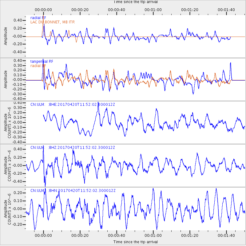
ULM LAC DU BONNET, MB - Earthquake Result Viewer
*The percent match for this event was below the threshold and hence no stack was calculated.
| Earthquake location: |
Kuril Islands |
| Earthquake latitude/longitude: |
44.4/148.7 |
| Earthquake time(UTC): |
2017/04/20 (110) 11:41:26 GMT |
| Earthquake Depth: |
61 km |
| Earthquake Magnitude: |
5.5 mb |
| Earthquake Catalog/Contributor: |
NEIC PDE/us |
|
| Network: |
CN Canadian National Seismograph Network |
| Station: |
ULM LAC DU BONNET, MB |
| Lat/Lon: |
50.25 N/95.88 W |
| Elevation: |
251 m |
|
| Distance: |
70.3 deg |
| Az: |
38.034 deg |
| Baz: |
316.557 deg |
| Ray Param: |
$rayparam |
*The percent match for this event was below the threshold and hence was not used in the summary stack. |
|
| Radial Match: |
49.74633 % |
| Radial Bump: |
400 |
| Transverse Match: |
51.36805 % |
| Transverse Bump: |
400 |
| SOD ConfigId: |
11737051 |
| Insert Time: |
2019-04-27 03:52:54.013 +0000 |
| GWidth: |
2.5 |
| Max Bumps: |
400 |
| Tol: |
0.001 |
|
Signal To Noise
| Channel | StoN | STA | LTA |
| CN:ULM: :BHZ:20170420T11:52:02.300012Z | 2.8593256 | 2.1395527E-7 | 7.4827184E-8 |
| CN:ULM: :BHN:20170420T11:52:02.300012Z | 1.2392714 | 1.17111924E-7 | 9.450062E-8 |
| CN:ULM: :BHE:20170420T11:52:02.300012Z | 1.649392 | 2.0805588E-7 | 1.2614095E-7 |
| Arrivals |
| Ps | |
| PpPs | |
| PsPs/PpSs | |


