You are here: Home > Network List > IC - New China Digital Seismograph Network Stations List
> Station KMI Kunming, Yunnan Province, China > Earthquake Result Viewer
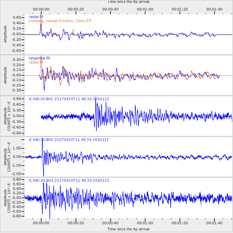
KMI Kunming, Yunnan Province, China - Earthquake Result Viewer
*The percent match for this event was below the threshold and hence no stack was calculated.
| Earthquake location: |
Kuril Islands |
| Earthquake latitude/longitude: |
44.4/148.7 |
| Earthquake time(UTC): |
2017/04/20 (110) 11:41:26 GMT |
| Earthquake Depth: |
61 km |
| Earthquake Magnitude: |
5.5 mb |
| Earthquake Catalog/Contributor: |
NEIC PDE/us |
|
| Network: |
IC New China Digital Seismograph Network |
| Station: |
KMI Kunming, Yunnan Province, China |
| Lat/Lon: |
25.12 N/102.74 E |
| Elevation: |
1975 m |
|
| Distance: |
41.8 deg |
| Az: |
258.147 deg |
| Baz: |
50.672 deg |
| Ray Param: |
$rayparam |
*The percent match for this event was below the threshold and hence was not used in the summary stack. |
|
| Radial Match: |
76.47841 % |
| Radial Bump: |
400 |
| Transverse Match: |
78.38365 % |
| Transverse Bump: |
400 |
| SOD ConfigId: |
11737051 |
| Insert Time: |
2019-04-27 03:53:48.424 +0000 |
| GWidth: |
2.5 |
| Max Bumps: |
400 |
| Tol: |
0.001 |
|
Signal To Noise
| Channel | StoN | STA | LTA |
| IC:KMI:00:BHZ:20170420T11:48:39.369012Z | 13.010798 | 8.0079093E-7 | 6.154817E-8 |
| IC:KMI:00:BH1:20170420T11:48:39.369012Z | 4.4383526 | 3.178187E-7 | 7.160735E-8 |
| IC:KMI:00:BH2:20170420T11:48:39.369012Z | 5.4161997 | 4.102359E-7 | 7.574239E-8 |
| Arrivals |
| Ps | |
| PpPs | |
| PsPs/PpSs | |


