You are here: Home > Network List > CI - Caltech Regional Seismic Network Stations List
> Station BAR Barrett, Tecate, CA, USA > Earthquake Result Viewer
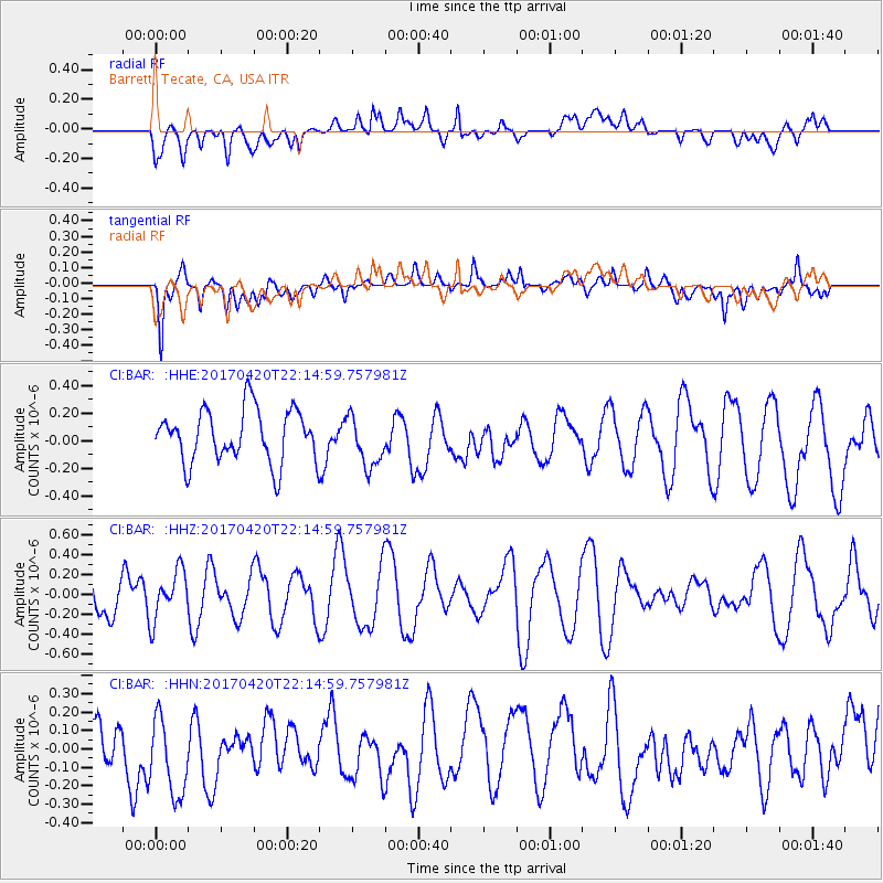
BAR Barrett, Tecate, CA, USA - Earthquake Result Viewer
*The percent match for this event was below the threshold and hence no stack was calculated.
| Earthquake location: |
Southeast Of Easter Island |
| Earthquake latitude/longitude: |
-36.3/-98.4 |
| Earthquake time(UTC): |
2017/04/20 (110) 22:04:14 GMT |
| Earthquake Depth: |
10 km |
| Earthquake Magnitude: |
5.5 Mwb |
| Earthquake Catalog/Contributor: |
NEIC PDE/us |
|
| Network: |
CI Caltech Regional Seismic Network |
| Station: |
BAR Barrett, Tecate, CA, USA |
| Lat/Lon: |
32.68 N/116.67 W |
| Elevation: |
521 m |
|
| Distance: |
70.7 deg |
| Az: |
343.736 deg |
| Baz: |
164.441 deg |
| Ray Param: |
$rayparam |
*The percent match for this event was below the threshold and hence was not used in the summary stack. |
|
| Radial Match: |
46.538403 % |
| Radial Bump: |
400 |
| Transverse Match: |
77.806656 % |
| Transverse Bump: |
400 |
| SOD ConfigId: |
11737051 |
| Insert Time: |
2019-04-27 04:02:36.288 +0000 |
| GWidth: |
2.5 |
| Max Bumps: |
400 |
| Tol: |
0.001 |
|
Signal To Noise
| Channel | StoN | STA | LTA |
| CI:BAR: :HHZ:20170420T22:14:59.757981Z | 1.1790518 | 2.4853037E-7 | 2.1078834E-7 |
| CI:BAR: :HHN:20170420T22:14:59.757981Z | 1.479591 | 2.484872E-7 | 1.6794314E-7 |
| CI:BAR: :HHE:20170420T22:14:59.757981Z | 0.9808051 | 1.8757312E-7 | 1.9124403E-7 |
| Arrivals |
| Ps | |
| PpPs | |
| PsPs/PpSs | |


