You are here: Home > Network List > CI - Caltech Regional Seismic Network Stations List
> Station TIN Tinemaha, Big Pine, CA, USA > Earthquake Result Viewer
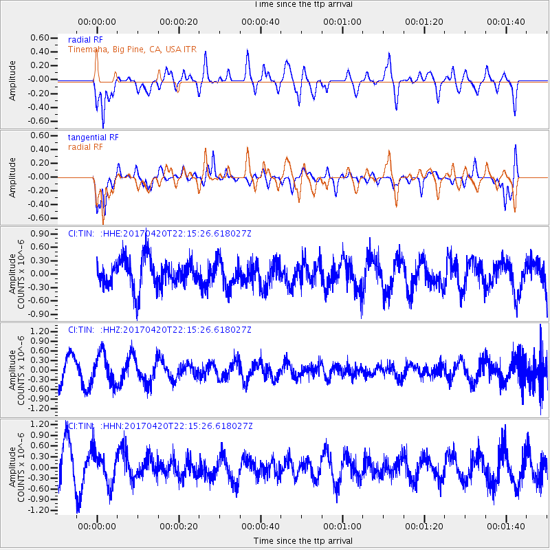
TIN Tinemaha, Big Pine, CA, USA - Earthquake Result Viewer
*The percent match for this event was below the threshold and hence no stack was calculated.
| Earthquake location: |
Southeast Of Easter Island |
| Earthquake latitude/longitude: |
-36.3/-98.4 |
| Earthquake time(UTC): |
2017/04/20 (110) 22:04:14 GMT |
| Earthquake Depth: |
10 km |
| Earthquake Magnitude: |
5.5 Mwb |
| Earthquake Catalog/Contributor: |
NEIC PDE/us |
|
| Network: |
CI Caltech Regional Seismic Network |
| Station: |
TIN Tinemaha, Big Pine, CA, USA |
| Lat/Lon: |
37.05 N/118.23 W |
| Elevation: |
1197 m |
|
| Distance: |
75.3 deg |
| Az: |
343.707 deg |
| Baz: |
163.545 deg |
| Ray Param: |
$rayparam |
*The percent match for this event was below the threshold and hence was not used in the summary stack. |
|
| Radial Match: |
46.836124 % |
| Radial Bump: |
400 |
| Transverse Match: |
75.81948 % |
| Transverse Bump: |
400 |
| SOD ConfigId: |
11737051 |
| Insert Time: |
2019-04-27 04:03:05.163 +0000 |
| GWidth: |
2.5 |
| Max Bumps: |
400 |
| Tol: |
0.001 |
|
Signal To Noise
| Channel | StoN | STA | LTA |
| CI:TIN: :HHZ:20170420T22:15:26.618027Z | 1.3894056 | 4.5934942E-7 | 3.3060857E-7 |
| CI:TIN: :HHN:20170420T22:15:26.618027Z | 1.0562354 | 4.444704E-7 | 4.2080617E-7 |
| CI:TIN: :HHE:20170420T22:15:26.618027Z | 0.9932189 | 3.119578E-7 | 3.1408763E-7 |
| Arrivals |
| Ps | |
| PpPs | |
| PsPs/PpSs | |


