You are here: Home > Network List > AV - Alaska Volcano Observatory Stations List
> Station MAPS Pakushin Southeast, Makushin Volcano, Alaska > Earthquake Result Viewer
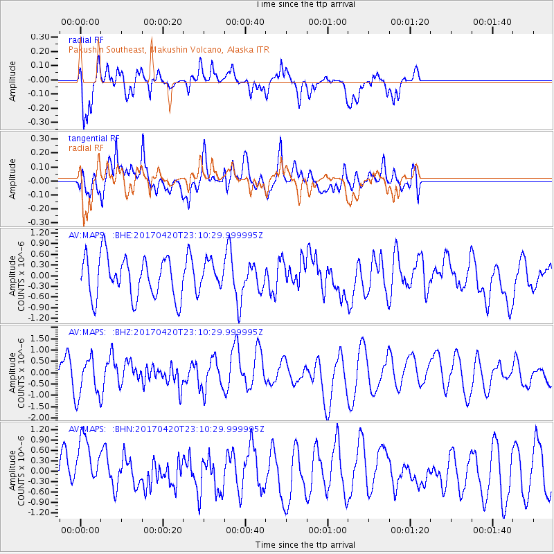
MAPS Pakushin Southeast, Makushin Volcano, Alaska - Earthquake Result Viewer
*The percent match for this event was below the threshold and hence no stack was calculated.
| Earthquake location: |
Tonga Islands |
| Earthquake latitude/longitude: |
-20.5/-173.6 |
| Earthquake time(UTC): |
2017/04/20 (110) 22:59:24 GMT |
| Earthquake Depth: |
13 km |
| Earthquake Magnitude: |
5.6 Mww |
| Earthquake Catalog/Contributor: |
NEIC PDE/us |
|
| Network: |
AV Alaska Volcano Observatory |
| Station: |
MAPS Pakushin Southeast, Makushin Volcano, Alaska |
| Lat/Lon: |
53.81 N/166.94 W |
| Elevation: |
333 m |
|
| Distance: |
74.3 deg |
| Az: |
4.099 deg |
| Baz: |
186.485 deg |
| Ray Param: |
$rayparam |
*The percent match for this event was below the threshold and hence was not used in the summary stack. |
|
| Radial Match: |
66.27283 % |
| Radial Bump: |
400 |
| Transverse Match: |
52.762398 % |
| Transverse Bump: |
400 |
| SOD ConfigId: |
11737051 |
| Insert Time: |
2019-04-27 04:10:33.214 +0000 |
| GWidth: |
2.5 |
| Max Bumps: |
400 |
| Tol: |
0.001 |
|
Signal To Noise
| Channel | StoN | STA | LTA |
| AV:MAPS: :BHZ:20170420T23:10:29.999995Z | 1.6951936 | 8.45385E-7 | 4.986952E-7 |
| AV:MAPS: :BHN:20170420T23:10:29.999995Z | 1.9234074 | 8.442468E-7 | 4.3893291E-7 |
| AV:MAPS: :BHE:20170420T23:10:29.999995Z | 0.6055003 | 3.5213836E-7 | 5.81566E-7 |
| Arrivals |
| Ps | |
| PpPs | |
| PsPs/PpSs | |


